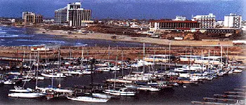
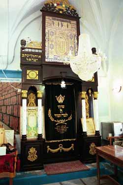
Tel Aviv & Jaffa
Put simply, Tel Aviv is where the action is in Israel.
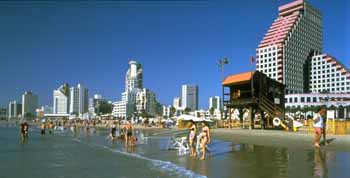
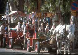
The beaches are clean and fulll of white sand, the sea enticing, the nightclubs hopping, the shopping plentiful and the restaurants appetizing. During the dy, stroll down Tel Aviv & Jaffathe boardwalk-style promenade or on the beach itself. At dusk, catch the nightlife seen along Dizengoff Street. Meet up at the sculpture fountain created by the acclaimed Israeli artist Yaacov Agam and go to a club, or just hang out and people-watch from an outdoor cafe. Tel Aviv is also a good base for exploring the northern and southern Mediterranean coasts.
 |
History
Tel Aviv is the first all-Jewish city in modern times. Originally named Ahuzat Bayit, it was founded by 60 families in 1909 as a Jewish neighborhood near Jaffa. In 1910, the name was changed to Tel Aviv, meaning "hill of spring." The name was taken from Ezekiel 3:15, "...and I came to the exiles at Tel Aviv," and from a reference in Herzl's novel Altneuland, in which he foresaw the future Jewish state as a socialist utopia.
Most Jews were expelled from Jaffa and Tel Aviv by the Turks during World War I, but returned after the war when Britain received the mandate for Palestine.
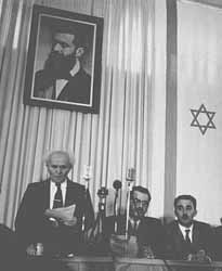
The population of Tel Aviv gradually swelled, particularly as Jews were stimulated to leave predominantly Arab Jaffa by unrest in the 1920s. Arab forces in Jaffa shelled Tel Aviv in 1948 prior to the beginning of the actual war. Jewish forces responded by capturing the city two days before declaring independence. The declaration was made in the home of the city's mayor Meir Dizengoff.
Because Jerusalem was occupied by Jordan after Israel became an independent state in 1948, the temporary capital and home of the government offices was in Tel Aviv. Several government offices remain there and Tel Aviv is still home to foreign diplomats from countries (including the U.S.) that don't recognize Jerusalem as Israel's capital.
Modern Tel Aviv
 |
Today, Tel Aviv is Israel's second largest city (after Jerusalem), with a population of 380,000, and among the big city problems it shares is traffic congestion. Things are more spread out in Tel Aviv than the smaller cities, but it's still often easier -- and faster -- to travel by foot. Walk along the Orange Routes, for example, to get acquainted with the city. Though much of the city is a drab gray, many buildings, especially along Rothschild Boulevard, actually have an interesting architectural pedigree that can be traced to the Bauhaus architecture of pre-Nazi Germany. There are over 5000 Bauhaus buildings, the largest number in any one city in the world. In fact, the city's “outstanding universal value” led UNESCO to recognize it as a “World Heritage Site." Tel Aviv is also known as, "The white city", named so in account of the the bright colors of the building style: white, off-white, light yellow. There are over 1,500 buildings marked for historic conservation in Tel Aviv.
Israel Fact
Fifty percent of the polished diamonds in the world come from Israel.
|
Tel Aviv is the country's business and cultural center. The Tel Aviv Stock Exchange, founded in 1953, and the Diamond Exchange, are two of major economic institutions in the city. For the arts, the Habima National Theater is excellent and the Israel Philharmonic Orchestra is world-class. The city also boasts several impressive museums and a top-flight university.
Though no Sears Tower or Empire State Building, the Azrieli Tower is the city’s tallest building, at 614 feet (the tallest in the country is Migdal Shaar Ayir in nearby Ramat Gan at 801 feet). Before the Observation Floor was opened to the public, Israel’s highest observation deck was the 433-foot-high rooftop of the Shalom Meir Tower, which had been Israel’s tallest building for 34 years. Due to terrorism threats, the Azrieli Towers’ mall, one of the busiest in Israel, is probably the world’s most secure shopping center.
 |
In addition to Dizengoff, other streets filled with shops, galleries and restaurants worth strolling are Allenby and Ben Yehuda streets. Off Rehov HaCarmel, for example, you'll find an open-air market. If you walk north (opposite Jaffa) down the seashore, beyond the Yarkon River, you'll reach a hip area of restaurants and clubs around the intersection of Dizengoff and Yirmiyahu streets.
The Tel Aviv Museum on Sderot Shaul Hamelekh is home to magnificent works of art, particularly sculpture and paintings by local artists. Another popular museum is the home of Israel's national poet Hayyim Nahman Bialik. A small, less visited museum is devoted to Nahum Gutman, one of Israel's most well-known artists.
 David Ben-Gurion's home in the center of Tel Aviv has also been turned into a museum. The modest digs are impressive because they show the simple way the country's most powerful politician lived. Besides a collection of awards and gifts assembled in the house, his awesome library of 20,000 volumes remains intact, filling much of the upper floor of the house and testifying to the man's thirst for knowledge.
A less well known museum is the Haganah Museum on Sderot Rothschild. It was set up in the apartment of the founder of the Haganah, Eliyahu Golomb. Despite being one of the most wanted men in Palestine, the British never found Golomb's home. Additions to the building now house collections of weapons and exhibits on the struggle for independence.
 |
 One can't miss attraction is Beth Hatefutsoth, the Museum of the Diaspora, on the campus of Tel Aviv University. It contains exhibits on the history of the Jewish people covering more than 2,500 years. The University itself is also a nice place to visit and a popular destination for foreign students spending time studying in Israel.
Tel Aviv University is in the suburb of Ramat Aviv. Another academic institution, Bar Ilan University is in the suburb of Ramat Gan. Some of the other well-known neighborhoods in Tel Aviv include the Orthodox enclave of B'nei Brak, the "Beverly Hills" of Israel, Savyon, and one Israel's earliest modern settlements, Petah Tikvah, which was founded in 1878.
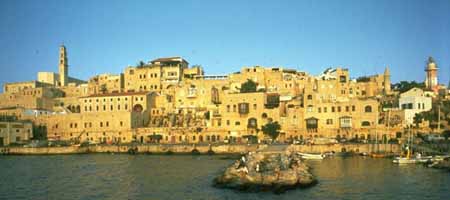
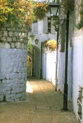
Jaffa
Jaffa has been a fortified port city overlooking the Mediterranean Sea for more than 4,000 years. It is one of the world's most ancient towns. It has been the target of conquerors throughout the ages because of its strategic locations between Asia, Africa and Europe.
Israel Fact
According to the Bible, Jonah left from Jaffa on his fateful voyage before encountering the whale. Christians learn hat St. Peter miraculously restored life to Tabitha in Jaffa.
|
Up until the early 20th century, when visitors came to Palestine, they usually arrived in Jaffa. The coast there is too rocky for ships to land, so they usually had to anchor offshore and send their passengers to the port in longboats and dinghies.
Today, Jaffa is a popular tourist destination because of its beautifully restored old quarter filled with galleries, shops and restaurants. One of the few religious sites is the house of Simon the Tanner, where, according to the New Testament, Peter first realized the gospel message had to be extended beyond the confines of Judaism.
You can walk from Tel Aviv, but it's a good 40 minutes, and once you get past the strip of hotels not as well-trafficked, especially at night. The easiest spot to locate is Hagana Square where the clock tower stands. It was built in 1906 by the Turkish Sultan, Abdul Hamid II, to commemorate his 30th anniversary as ruler.
 |
If you head toward the minaret towering over the Mahmoudiya Mosque, you'll find yourself in a Middle Eastern buffet, with cafes and kiosks selling all of the region's delicacies.
The Visitors' Center in Kedumim Square has exhibits of archaeological remains and the history of Jaffa. The square is a good place to sit and have a picnic and people watch. At night, bands often play here. The streets off the square are lined with shops, nightclubs and cafes.
The ancient port is now a modern sailing facility and a tourist attraction with restaurants and entertainment.
Neve Tzedek
The beautiful area of Neve tzedek (Oasis of Justice) was actually the first neighborhood of Tel Aviv. It was established in 1887 on land that belonged to a political activist named Aaron Shlush. You can still see his house as well as other old buildings representative of the architecture of the early days of settlement in Israel. Don't miss the Suzanne Dellal Center for dance and theater, the home of the world famous BatSheva Dance Company. Neve Tzedek is the home of many artists whose works are displayed throughout the area. Pull up a chair at a sidewalk cafe and relax before continuing your tour.
Ashkelon & Surroundings
PLACES TO VISIT:
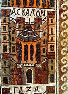
Ashkelon
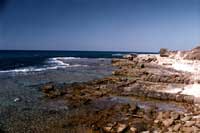
Israel has one of the world's most beautiful coastlines, with white sandy beaches and spectacular Mediterranean views. The coast stretches to the northern border with Lebanon at Rosh Hanikraand south to the Gaza Strip. Just north of Gaza and 36 miles south of Tel Aviv is the southernmost stop for most tourists, the city of Ashkelon.
Israel Fact
Archaeologists have unearthed a large cemetery for dogs in Ashkelon. They do not know the significance of this cemetery or why dogs would have merited this treatment.
|
Like so many other places in Israel, Ashkelon is built upon the ruins of past civilizations. This was one of five Philistine city-states (along with Gath, Gaza, Ekron and Ashdod). The city also plays a role in biblical history as the place where Delilah cut Samson's hair to sap his strength (Judges XIV-XVI). Ashkelon was also a great trading center because it lay along the Via Maris, the route linking Egypt with Syria and Mesopotamia.
The city was first settled at the end of the third millenniumB.C.E. It was conquered by the Philistines in the second half of the 12th century. After the Israelite conquest of the rest of the area, the two peoples engaged in several hundred years of conflict. After King Saul was slain by the Philistines, David lamented:
Tell it not in Gath, publish it not in the streets of Ashkelon; lest the daughters of the Philistines rejoice, lest the daughters of the uncircumcised triumph. (II Samuel 1:20)
Even after David defeated the Philistines in much of the rest of the country, he could not dislodge them from Ashkelon. This was finally accomplished by the Assyrian conqueror Tiglath-Pileser III in 734 B.C.E. After roughly 600 years in the region, the Philistines disappeared forever.
 The city passed through the hands of the region's subsequent invaders before enjoying a renaissance under the Greeks and Romans. After the Jews, under the leadership of the Maccabeans, overthrew the Greeks in the 2nd century, Ashkelon became an autonomous city. It is believed that Ashkelon was the birthplace of Herod (in 37 B.C.E.), who enlarged and beautified the city, constructing a summer house, palaces and an aqueduct. Under the Romans, Ashkelon was also granted the rare privilege of being exempt from taxes. It became a flourishing trade center and, in particular, a major wine producer.
The city became a Christian city in the Byzantine period and was captured by the Muslims in 638 C.E. The Crusaders came next in 1153, but were defeated by Saladin. Richard the Lion Heart led the Crusaders back, but they were eventually driven out in 1280 by Sultan Baybars. The city was then abandoned until 1948 when the Jews of the new State of Israel began to rebuild it. Ashkelon was reestablished as an Israeli city in 1953.
 Today, Ashkelon is enjoying a growth spurt, fueled in part by immigrants from the former Soviet Union. The population is now roughly 90,000. This is primarily a place to hit the beach, though some interesting archaeological ruins are continuing to be unearthed. These include a Byzantine church, aRoman tomb and one of the oldest arched gateways in the world. One of the most notable recent finds is a bronze and silver calf that is more than 3,500 years old and may be distantly related to the biblical tale of the golden calf.
The National Park
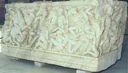
This is the site in Ashkelon of the ancient cities. It is located on the southern coast of modern Ashkelon. From the entrance, the road passes through the 12th century Crusader city walls and the Canaanite earth ramparts. There are several ongoing excavation sites near the sea, which reveal the city's biblical roots. One of the most intriguing sections of the Park is the sculpture garden, in which many Roman statues stand. There are also several ruins of Byzantine and Crusader churches nestled within the Park.
Yad Mordechai
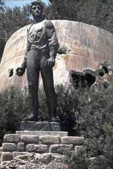 Just south of Ashkelon is Kibbutz Yad Mordechai, which was founded in 1943 and named after Mordechai Anilewicz, the leader of the Warsaw Ghetto uprising. A giant statue of the hero overlooks the community. Behind it is the Kibbutz's old water tower that was shelled by the Egyptians during the 1948 War.
The kibbutz has a museum dedicated to the ghetto fighters. It also has its own exciting history because it was on the frontline during the War of Independencein 1948 and was captured and destroyed by the Egyptians. The kibbutz was subsequently recaptured and rebuilt. The kibbutz also has reconstructed a scene from the war with life-size cut-outs with rifles and helmets representing the Egyptians.
Ashdod
 Back along the coastal road toward Tel Aviv is another of the major Philistine cities, Ashdod. It was the Philistines who made the mistake of taking the Ark of the Covenant (I Samuel 5, 1-6) and bringing it to Ashdod. Afterward, the community was struck by a number of calamities that led the Philistines to return the Ark to the Israelites.
About four miles south of the present city is Tel Ashdod, the site of the biblical city that was first mentioned in the Tanakh as one of the cities allocated to thetribe of Judah (Joshua 15:47). Ashdod was an important city because of its location along the coastal route leading from Egypt to Syria and Mesopotamia.
Ashdod also has significance to Christians because Philip the Evangelist (or the Deacon) received "the call" to go into the desert and preach to a eunuch, a minister of the queen of Ethiopia. Philip converted and baptized the man and returned along the coast through Ashdod where he preached to its citizens (Acts 8).
At the southern entrance of the city is a bridge where the fledgling Israeli army stopped the Egyptian Army's advance toward Tel Aviv in the 1948 War.
It was founded by the Jews in 1957, and has been rapidly developing since. Today, Ashdod is a thriving city of 150,000 people, which has surpassed Haifa as Israel's busiest port, which was constructed in 1966. Ashdod's two power plants also supply roughly half of Israel's electricity.
Rishon Lezion
Further north is Rishon Lezion, a town founded in 1882 by Russian immigrants that has grown into one of Israel's principal wine centers. Baron Edmond de Rothschild provided funding that helped establish the wine industry. Free guided tours are available at the wineries. This is also where the first kindergarten and elementary schools were founded.
Rehovot
Traveling inland not far from Rishon Lezion is Rehovot, the home of the Weizmann Institute of Science. The university was dedicated in 1949 in honor of Chaim Weizmann, Israel's first president, who actually founded the institution as the Sieff Institute in 1934. Dr. Weizmann, who was a renowned chemist himself, and his wife had a home on the campus as well, which is now open to the public. Weizmann's tomb is also nearby.
Rehovot is also home to the Ayalon Institute Museum. This was an underground munitions factory used during the mandatory period.
Kiryat Gat
A rapidly growing town 15 miles east of Ashkelon, Kiryat Gat is near the tel believed to be the site of Gath, one of the five important Philistine cities and the birthplace of Goliath.
Lachish
The town of Lachish 20 miles east of Ashkelon may have first been inhabited 5,000 years ago. It is first mentioned in the Bible when Joshua killed all the people and hung its king (Joshua 10:22-32). King David developed the city and his grandson Rehoboam fortified it. In the 6th century B.C.E., however, the Babylonian conqueror Nebuchadnezzar destroyed the city. When Jews returned after their Babylonian exile, they rebuilt the city. It was abandoned again, however, after the destruction of the Second Temple in 70 C.E. and was never resettled.
Beit Guvrin
 When Maresha fell in the 1st century BC, the nearby city of Beit Guvrin became an important regional center. An ancient city 24 miles east of Ashkelon. The city was at the center of the largest region in Palestine during the Romanoccupation and was enlarged and fortified by the Roman Emperor Septimus Severus. It was conquered by the Crusaders who built a citadel. Saladin destroyed the city. Evidence of Jewish life is the 3rd century synagogue ruins. The ornate Sidonian tombs are testaments to the affluence of the 3rd and 4th century inhabitants.
Not far from the Crusader ruins are a series of enormous limestone caves, some of the 800 in Beit Guvrin, dating back to the Hellenistic times. The caves were used as water cisterns, animal pens, burial, raising pigeons, oil industry and, more recently, as one of the sets for the film Rambo III. Some caves were also used as churches and you can still see crosses carved on the walls. Ongoing excavations are uncovering a Roman amphitheater near the entrance to Kibbutz Beit Guvrin.
Israel Fact
Small holes cut into the limestone of the caves puzzled scholars for years until they figured out they were used to raise pigeons for meat, communications and sacrifices.
|
Also nearby is Tel Maresha, another hill fortified by Rehoboam. An interesting historical fact is that when the Hasmonean ruler, John Hyrcanus, captured the area in 125 B.C.E., he forcibly converted the Idumean population to Judaism to ensure their loyalty.
Amatzia
Another series of caves are in Amatzia, a small park east of Ashkelon and south of Beit Guvrin. The complex of caves was used by Jewish rebels during the Bar-Kokhba Revolt in the 2nd century. Approximately 300 people lived in the cavern's 35 rooms. The restored complex includes an underground synagogue, a guard room, water cisterns, store rooms, an oil press and secret hideaways.
Tel Ekron
Northeast of Ashkelon is another of the five great Philistine cities, Ekron. The city was founded in the twelfth century B.C.; first mentioned in the Bible in Joshua 13:2-3. Under Assyrian rule, Ekron became the largest olive-oil production center in the ancient Near East. More than 100 oil presses were found here. It supplied the Egyptian and Assyrian Empire with as much as 700 tons of oil a year. Artifacts from the Philistine period and a reconstructed Philistine street are in nearby Kibbutz Revadim.
 Since it doesn't have any major tourist attractions, the city is sometimes overlooked, but it is a convenient stop, just one hour from Jerusalem, thirty minutes north of Tel Aviv and twenty minutes south of Caesarea.
Herzliya
o the north of Tel Aviv is the growing resort city of Herzliya, which was named after one of the founders of the Zionist movement, Theodor Herzl. The city boasts some of the finest beaches in Israel and this, combined with the proximity to Tel Aviv, has made it popular with the country's elite. The area near the beach, Herzliya Pituach, is home to many diplomats and wealthy Israelis.
Herzliya boasts two fine museums, the Founders' House, which depicts the everyday life of the town's first settlers, and the Herzliya Museum of Israeli Art & Sculpture Garden, which exhibits the work of contemporary Israeli artists.
Netanya
Israel is so full of unique things to see and do, and tour schedules are so packed, it is sometimes difficult to find time to just relax. Well, if you can make the time, there's no better place than the beaches of Netanya, some of the most beautiful in Israel.
Since it doesn't have any major tourist attractions, the city is sometimes overlooked, but it is a convenient stop, just one hour from Jerusalem, thirty minutes north of Tel Aviv and twenty minutes south of Caesarea.
Netanya was founded in 1929 by citrus farmers, but is now is primarily a center for tourism and the diamond trade. Israel is one of the world's largest exporters of diamonds (this is the country's principal export to the U.S.), and Netanya is home to many diamond-cutters and polishers who came to Palestine primarily from Belgium before and during World War II.
- Netanya was named in honor of philanthropist Nathan Straus, the owner of Macy's department store in New York at the turn of the century.
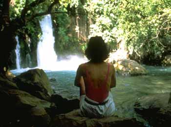 A far more scenic and fun place to visit is the Banyas Springs Nature Reserve. The Banyas is another source of the Jordan River. The area was first settled around the 3rd century B.C.E. and, during the year 2 B.C.E., became the capital of a Roman kingdom. The town later became an important Christian center and is referred to in the New Testament as the place where Jesus determined that Peter would be "the rock" on which the church would be built. The name is derived from the Greek Paneas, (after the god of fertility, Pan). Since Arabic doesn't have a "p" sound, it was changed toBanyas in Arabic. Today, the Banyas are a great place to hike to see waterfalls and to go river rafting.
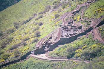 About six miles from Katzrin is another of the fascinating strongholds of early Jewish history. Gamla became home to Jewish refugees fleeing the Romans after the revolt broke out in 66 C.E. The Romans laid siege to the city, whose defenders heroically held out for some time before being overcome. Most of the Jews were killed, though many chose to jump off the cliffs to commit suicide rather than be captured. Gamla derived its name fromgamal (Hebrew for camel), since it was situated on a hill shaped like a camel's rump.
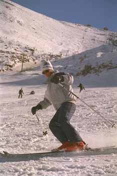 Though Mount Hermon's highest peak is more than 9,000 feet high, the top elevation under Israeli control is Mizpe Shelagim, the "Snow Observatory," at about 7,300 feet (2,224 m.). U.S. observers have a base on the mountain, and both Israel and Syria have observation posts. For a really unusual Israel experience, you can try skiing on Mount Hermon during the winter months (roughly December-April). The longest run is more than a mile, but experienced skiers will not mistake the mountain for Aspen. A lift for non-skiers goes to the summit and affords a spectacular view of the surrounding area.
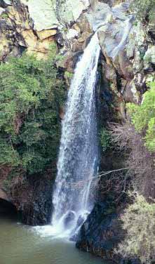 Driving through the Golan, you see beautiful mountains, rocky hillsides, green valleys and wild flowers. You can also find spectacular waterfalls off the main roads near Gamla and below Nimrod's Castle. Of course the falls are only in full force during winter and early spring; by summer, many of them dry up.
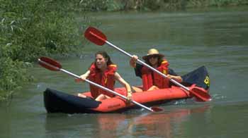 Parts of the valley have begun to recover and wildlife is returning. Even this is a mixed blessing, however, as the Israeli desire to promote tourism in the area conflicts with environmentalists' efforts to better protect the area. For now, the Hula Nature Reserve offers places to see birds and other animals. You can also go kayaking nearby in the Jordan River.
 Jews began to come in large numbers after they were expelled from Spainin 1492 (while Columbus was sailing the ocean blue). The city is most closely associated with Jewish mysticism, the kabbalah, whose foremost exponent, Rabbi Isaac Luria, lived and taught there. Known as "Ha'Ari" (the lion), Luria had come from Egypt in 1569 and died just three years later. The "bible" of the kabbalists, the Zohar, was written by the second-century talmudist Rabbi Shimon bar Yochai, who believed each word and line of the Torah had a higher meaning. The author of the main part of the Zoharwas Moses de Leon (12th century) in Spain.
 The Jewish community thrived in Safed for more than 400 years before the outbreaks of violence in Palestine provoked many residents to leave. The1929 Arab riots stimulated a gradual decline that resulted in the Arabs becoming the majority in the city. When the British withdrew from Palestine in 1948 and handed the Citadel over to the Arabs, the remaining Jewish residents, backed by reinforcements from the Haganah, held off the Arab forces and kept the city a part of the new state of Israel.
- Netanya was named in honor of philanthropist Nathan Straus, the owner of Macy's department store in New York at the turn of the century.
Caesarea
Thinking Roman city, right? What gave it away? Yes, Caesarea is a city that Herod the Great dedicated to Caesar Augustus more than 2,000 years ago. Today, it is one of Israel's major tourist attractions and an increasingly popular place for Israel's elite to make their homes.
History
 |
Caesarea was originally called Straton's Tower after its founder Straton, who is believed to have been a ruler of Sidon in the 4th century BCE. In 96 BCE the city was captured by Alexander Yannai and remained in the Hasmonean kingdom until it became an autonomous city by Pompey. After being for some time in the possession of Cleopatra, ruler of Egypt, it was returned by Augustus to Herod.
Once the site of a Phoenician port, over the course of 12 years Herod built Caesarea into the grandest city other thanJerusalem in Palestine, with a deep sea harbor (called Sebastos, i.e., Augustus in Greek), aqueduct, hippodrome and magnificent amphitheater that remain standing today. Herod renamed the city Caesarea in honor of the emperor. The population of Caesarea was half gentile and half Jewish, often causing disputes among the people. In 6 CE, Caesarea became the home of the Roman governors (Procurators) of Judea. The city remained the capital of Roman and Byzantine Palestine.
The Great Revolt of 66-70 CE started in Caesarea when the Jewish and Syrian communities began fighting over a pagan ceremony conducted on Shabbat near the entrance of a synagogue. TheRomans ignored the Jewish protests of this provocation and violence soon spread throughout the country. When the Romans finally quelled the revolt, and razed Jerusalem, Caesarea became the capital of Palestine, a status it maintained until the Roman Empire was Christianized by the Emperor Constantine in 325 CE.
Caesarea was also the site where the Romans tortured and executed Rabbi Akiva following the Bar Kochba revolt in 135 CE.
Israel Fact
Israel's only golf course is located inCaesarea.
|
Caesarea is an important site in Christian history. It was the place where Pontius Pilate governed during the time of Jesus. This was where Simon Peter converted the Roman, Cornelius, the first non-Jew to believe in Jesus. Paul was also imprisoned for two years in Caesarea. During the 3rd century, Caesarea was a center of Christian learning. In the 4th century, the site converted to Christianity and became a major center of the Christian Roman Empire.
In 640 CE, Caesarea was the last Palestinian city to fall to the Muslim invaders. After the Muslimsswept out of Arabia and across the Middle East, driving out the Romans, Palestine was largely neglected. In 1101, the Crusaders captured the city under the leadership of Baldwin I, only to lose it in 1187 to Saladin. Under the Crusader rule, the Jewish community of Caesaria dwindled until in 1170 only 20 Jews remained. From 1251-1252, the city was entirely reconstructed by Louis IX.
In 1265, Caesarea fell to Baybars, the Mamluk sultan of Egypt, who destroyed the city, which remained in ruins until 1884. In 1884, a small fishing village was established on the remains at Caesarea by Muslim refugees from Bosnia. The city was abandoned by its inhabitants during the War of Independence (1948).
Relics
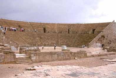 |
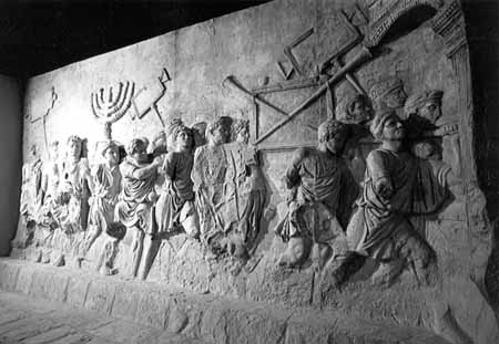
Today, the amphitheater is not only a spectacular relic of the past, but a modern performing venue where concerts are frequently held. Inside the gate of the theater is a plaque with a replica (the original is in theIsrael Museum in Jerusalem) of the inscription found during excavations in 1959-63 with the words "TIBERIVM" and "TIVS PILATUS," references to Emperor Tiberius and Pontius Pilate, the governor of Judea at the time of Jesus. This was an important find because it is the only archaeological evidence of Pilate's existence.
Undoubtedly, you'll be informed that the entrances to the theater are known as vomitoria. The name does not come from the reaction of patrons to a show, but is simply a word meaning vaulted passageway. The inside of the theater is not only impressive as a remnant of the glory days of Rome, but for its spectacular view of the Mediterranean.
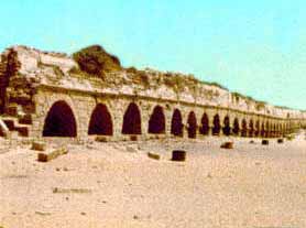
In 21 BCE, Herod the Great built a massive, two-part harbor, an inner and outer harbor, at Caesarea. The all-weather harbor was constructed by using hydraulic concrete to create breakwaters in the sea. The harbor took twelve years to construct. Herod named the harbor Sebastos, in honor of Emperor Augustus.
The Roman historian Flavius Josephus describes the harbor; "the king triumphed over nature and constructed a harbour larger than the Piraeus, including other deep roadsteads within its recesses. Notwithstanding the totally recalcitrant nature of the site, he grappled with the difficulties so successfully, that the solidity of his masonry defied the sea, while its beauty was such as if no obstacle had existed."
Archeological evidence suggests that the outer harbor had serious structural problems by the end of the 1st century CE. Today the Herodian breakwaters are submerged 5m below the water surface.
The hippodrome built by Herod also is still identifiable, though it is now a banana field. Considerably smaller than the great Circus Maximus in Rome, Herod's arena still held 20,000 spectators for chariot races.
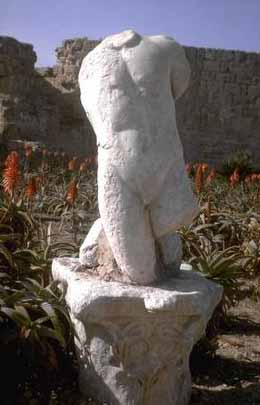 |
The later rulers also left behind interesting artifacts, in particular, two huge white marble statues, both headless. They probably were originally made to honor two Roman emperors, but no one knows which ones. It is also a mystery as to how the statues lost their heads. They could have been lopped off by Christians, Muslims or Jews angered by the way they were treated by the Romans or offended by such idols.
Vestiges of the fortress walls built by the Crusaders are monuments to yet another fascinating period in Israel's history. One of the legendary acts of particular interest to Christians involves the Holy Grail, the goblet that was said to have been used by Jesus at the Last Supper. The Grail was supposedly taken to Genoa as booty by the Genoese invaders who helped the Crusaders conquer the city in 1101.
The Crusader fortifications were embellished by King Louis IX of France -- St. Louis -- who spent a year in Caesarea after being released from prison in Egypt in 1251. He helped build the city walls with his own hands. In 1265, the Mamluks drove out the Crusaders and the Sultan tore down the walls, reputedly saying, "What a king has built, a king will destroy."
 |
Other archaeological finds from Caesarea can be seen in the museum at nearby Kibbutz Sdot Yam. In addition to exhibits of antiquities, the kibbutz is also the home of the Hannah Senesh House, a museum depicting the heroic story of the young woman who volunteered for the British army and parachuted behind enemy lines during World War II. Senesh (also Szenes) was captured and tortured, but would not betray her comrades. She was executed by the Germans in 1944.
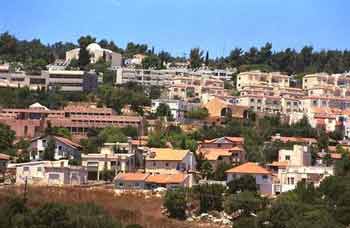
Zichron Yaacov
Just 15 minutes north of Caesarea, nestled in the mountains overlooking the sea, is the town of Zichron Ya’acov. Founded by Baron Edmond de Rothschild in 1882, the town is named after the Baron's father James (Jacob of Ya'acov in Hebrew). Before the Baron died in Paris in 1934, he said he wanted to be buried in the Holy Land. After the establishment of Israel, the Baron's son had his body and that of his wife reinterred near the town on the Heights of the Benefactor (the name given to Rothschild) or Ramat Ha-Nadiv. Today, the tombs are set in beautiful gardens filled with the varieties of plants the Rothschilds helped develop in Israel.
This is also the home of Israel's famous Carmel wineries, which began operations in 1886 and now offer tours that conclude with wine tasting.
During World War I, the town served as the headquarters for the Nili spy organization that included Sarah and Aaron Aaronsohn. The Aaronsohn House now houses a small museum devoted to the family's history.
Haifa
 |
If someone asks you to name a beautiful cosmopolitan, liberal and diverse city on a hill with a spectacular view of the water, you'll probably say San Francisco.
After you've been to Israel, however, your answer will undoubtedly change.
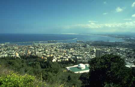
One of the many jewels of Israel is the city of Haifa, a clean and green city that stretches from the shores of the Mediterranean up the slope of Mt. Carmel and is topped off by the high-rise University of Haifa. Israel's largest major port is located here and its the place where both people and goods enter the country.
History
Although it does not appear in the Bible, Haifa is mentioned in Talmudic literature as a well-established Jewish community. Across from the National Maritime Museum on Allenby Road are steps to Elijah’s Cave. According to a Byzantine tradition, this is where Elijah the Prophet hid to escape the wrath of King Ahab. The site is revered by Christians and Muslims, as well as Jews. The first Sunday after Tisha B'Av, Oriental Jews recite Isaiah 40 and ask the prophet to bless their children, cure their illnesses and better their lives.
Relics found within the city limits date from the Stone Age to the Ottoman period. During the Middle Ages, the Jewish settlement in Haifa grew into a shipping center. In 1099, the city was conquered by the Crusaders, who slaughtered all the Jewish inhabitants. The Carmelite Order was established in 1156 over Elijah’s Cave. In 1265, Haifa fell to the Mamlukes, and in 1750 was captured by the Bedouin, Dahar al-Omar, who destroyed, then rebuilt and fortified it. From 1775 until World War I, Haifa was under Turkish control with two interruptions — in 1799, it was conquered by Napoleon and, from 1831-1840, it was under Egyptian rule. In the case of Napoleon, when he retreated from Palestine, he left his wounded soldiers at the Carmelites' hospital at Stella Maris. As soon as the emperor was gone, the local Muslims murdered the Frenchmen he'd left behind.
Early in the 19th century, Jews from North Africa settled in Haifa. In 1868, German Templars established Haifa's German Colony and in 1879 European Jews settled in the city.
In 1905, a railroad was built from Constantinople to the Muslim shrines of Mecca and Medina in Arabia. The railway passed through Damascus and had a spur that connected with Haifa. That line is long dormant. Today, one of the few places Israelis travel by train is between Tel Aviv and Haifa.
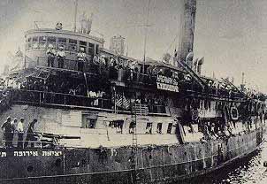 |
In 1918, Haifa was taken from the Turks by the British. During the Mandate period, it was the scene of many dramatic confrontations between the British who sought to keep Jews from entering Palestine and the clandestine efforts of the Haganah to smuggle in immigrants and the survivors of the Holocaust. One of the ships used to run the British blockade, an old American tank-landing craft called the Af-Al-Pi-Chen is in the Clandestine Immigration and Maritime Museum.
The large Arab population had relatively good relations with the Jews, even during the British Mandate. After partition, however, a number of violent incidents created tensions, and the Arab decision to prevent the establishment of a Jewish state by force led to the evacuation of much of the Arab population in April 1948 when the Haganah took over the city.
Modern Haifa
The city is divided into four main areas. At sea level, you'll find the bay and port, beaches, some residential neighborhoods and one of the main centers of Israeli industry. Major products produced in Haifa include cement, chemicals, electronic equipment, glass, steel and textiles. Haifa is also where Israeli oil is refined.
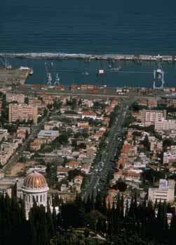 |
As you make your way up the hill, you'll enter Hadar Hacarmel, the commercial center of the city and the home of some of the older neighborhoods. This is the location of City Hall and the old campus of the Technion, sometimes referred to as the MIT of Israel (or is MIT the Technion of the U.S.?). The Technion was founded in 1912, but didn't open for another 12 years because of the onset of World War I and an internal dispute over whether the school should teach in German, the native language of many of the scientists, or in newly revived Hebrew.
Higher still is the Mt. Carmel area, which has newer residential neighborhoods and is where you'll find most of the entertainment, cultural and tourist activities. A bit off the beaten path, beyond the commercial and residential section of the city is the University of Haifa.
You can walk around Haifa, and it's beautiful, but if you plan to move from area to area, consider public transportation, especially the cable car (Carmelit), since the hills can wear you out. If you prefer to walk, take the "path of the thousand stairs" that starts from the scenic lookout on Yefe Nof Street (Panorama) in Central Carmel and leads down the mountain past the Baha'i Shrine and the German Colony and ends downtown.
On Mt. Carmel, don't miss Panorama Road and its spectacular view of the sea. If you're lucky, you may catch glimpses of the U.S. Sixth Fleet and other naval vessels which frequently come throughHaifa, one of the sailors' favorite ports of call.
An Island of Tolerance
 |
Haifa is the third largest city in Israel, with a population of approximately 250,000, and perhaps its most progressive. It has always had a large Arab population and, today, Haifa is one of the few places in Israel where Jews and Arabs are in regular contact and make genuine efforts to promote coexistence. Beit Hagefen is one of the organizations that runs programs in the city for Jews and Arabs.
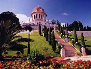
Other minorities have also found Haifa a comfortable place to live. In fact, it is the world headquarters for the Baha’i faith, whose spectacular golden-domed shrine of the Bab is one of the city's landmarks. The shrine, along with the fabulous gardens at the center, make the center a popular tourist attraction.
Haifa is a blue-collar town -- it is the place where the Histadrut was founded in 1920 -- that also has a reputation for having a more pluralist approach to Judaism. It is the only city in Israel where the buses run on Shabbat and where many businesses stay open. This has enhanced the city’s image as a good party town. Moreover, the city is a cultural mecca with its own symphony orchestra, theaters, museums and a zoo.
The road running past the Baha'i Shrine to the top of Mt. Carmel is known as Sedorot Hatziyonut, Zionism Blvd. Originally the street was named U.N. Blvd. in honor of the international body's role in the creation of Israel. After the UN adopted its infamous resolution equating Zionism with racism in 1975 (which was revoked in 1991), the name was changed.
The road running past the Baha'i Shrine to the top of Mt. Carmel is known as Sedorot Hatziyonut, Zionism Blvd. Originally the street was named U.N. Blvd. in honor of the international body's role in the creation of Israel. After the UN adopted its infamous resolution equating Zionism with racism in 1975 (which was revoked in 1991), the name was changed.
Acre (Akko)
The city of Acre (Akko) is one of the oldest continuously inhabited cities in the world, dating back to the time of the Pharaoh Thutmose III (1504-1450 BCE).
It is a city of intrigue, where you can walk through labyrinthine alleys and streets and explore the remnants of Crusader, Muslim and Ottomanconquerors. Walking along the walls of the city, you also get a spectacular view of the sea and, on clear days, the city of Haifa.
History
Israel Fact
According to legend, a bulldozer working on the street pavement chipped a corner off a Turkish building and sand poured out. Archeologists arrived and, as tons and tons of sand were removed, a huge and magnificent crusader hall, with three massive columns in the center supporting a cross-vaulted ceiling, was revealed.
|
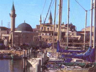
Acre was once a leading port in the Middle East, in the same league as Alexandria and Constantinople. Today, it is home primarily to small fishing boats.
A part of the kingdom of Israel, Acre was incorporated into the empire of Alexander the Great after his conquest in 332 B.C.E. The city was subsequently seized by the Egyptian king Ptolemy II, who renamed the city Ptolemais in the 2nd century B.C.E. This name stuck until the Muslim conquest in the 7th century CE, when its ancient name was restored. Confusion over what to call the city was compounded by the Crusaders' conquest in 1104, after which it became known as St. Jean d'Acre, or Acre for short.
In 1291, the Mamluks invaded and destroyed the city, killing every remaining Crusader and putting an end to the Latin Kingdom. Acreceased to be a major city for almost 500 years. When the Bedouin sheikh Daher el-Omar carved a small fiefdom out of the Ottoman Empire in the mid-18th century, he made Acre his capital and built a large fortress. It was subsequently fortified by the Turkish governor (1775-1804), Ahmad Pasha al-Jazzer ("The Butcher"). The mosque al-Jazzer built is one of the most beautiful in Israel and the most distinctive building in the old city.
Israel Fact
King Richard I of England (1157-99), took Acre in 1191 from the Saracens. He executed 2,700 Muslim prisoners of war; nevertheless, because of his "valorous" behavior during the Crusade, he became known as Richard the Lion-Hearted.
|
Napoleon landed in Palestine and assaulted Acre in 1799, but he was unable to take the city. His Middle Eastern campaign subsequently collapsed and he withdrew to France.
Acre fell under Ottoman control until the Turks were defeated in 1918 by the British. The city subsequently became part of the British Mandate for Palestine. The British used the ancient fortress, which had never been breached, as a high-security prison to hold (and execute) members of the various Jewish underground groups. On May 4, 1947, members of the Irgun staged a dramatic rescue(dramatized in the film Exodus). Though few Jews escaped, the audacity of the raid was a serious blow to British prestige and a tremendous boost for the morale of the Jews. Today, the fort is the site of the Underground Prisoners Memorial Museum, which depicts the history of Acre and the prison. You can go into the death cell where the condemned were kept and the gallows where a noose still hangs above an open trap door.
Portal to the Past
On May 17, 1948, shortly after the Arab invasion, Israeli troops took control of Acre and most of the Arab inhabitants fled. It was subsequently incorporated into Israel after the War of Independence.
Check out Khan El Umdan, the 18th century structure where camel caravans once brought grain and produce from Galilee to the market. The name means "inn of the pillars," for the fine granite Herodian pillars brought from Caesarea to support the structure. The clock tower is a much later addition, built in 1906 in honor of the Turkish sultan Abdul Hamid.
 |
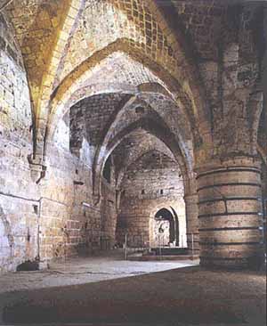
Across from the mosque is the entrance to the subterranean Crusadercity. You can walk down to different levels and see how the Turks built on top of the old city. One of the more spectacular rooms is the Knights' Halls, which the Hospitallers, the Order of the Knights of St. John, used as a fortress more than 700 years ago. Today, the main hall is used for concerts. The lowest level is the Crypt, a great hall that may have been used for great ceremonies by the Crusaders.
Elsewhere in the city is the home of Baha Allah, the prophet of the Baha'i faith. His tomb is in a park just outside of town along the Acre-Nahariya road. As in the headquarters in Haifa, the grounds have spectacular gardens.
Today, the population of Acre is approximately 40,000 and has one of the higher proportions of non-Jews of any of Israel's cities, with roughly 25 percent Christians, Muslims, Druze and Baha'is. The city is a magnet for tourists and the home of the country's steel industry.
 Opposite the water is a hill on which Kibbutz Haziv sits. The kibbutz is one of the largest turkey breeders in the country. It is more famous in Israel for its association with an incident during the British mandate. In June 1946, the Haganah simultaneously blew up 11 bridges linking Palestine with neighboring Arab countries. One team was to blow up the Achziv bridge, but was spotted by British soldiers who fired on them. One of the bullets inadvertently hit the explosives the Jews were carrying and set them off. The explosion blew up the bridge, but killed 14 men as well.
 Ma'alot is an immigrant town 11 miles east of Nahariya was founded in 1957. This small town made world headlines when a group of 11th graders on a field trip from Safed spent the night in a school in Ma'alot. On May 15, 1974, three PLO terrorists disguised in Israeli uniforms, who had infiltrated from Lebanon, killed the school children's guard and stormed the building. Some children were killed as the terrorists entered, others escaped through a window on the second floor. The terrorists threatened to kill the remaining children unless Israel released Arab terrorists held in Israeli prisons. Israel's official policy was not to negotiate with terrorists, but the government decided to ask for more time to talk. The terrorists rejected the request. Fifteen minutes before the terrorist-imposed deadline for starting to kill their hostages, an elite Golani brigade unit mounted a rescue operation. When it was over all the terrorists were dead, but so were 21 children who had been murdered by the Arabs.
 In 1963, Ma'alot merged with Tarshiha, a 900-year-old neighboring Muslim and Christian Arab village to form a single municipality. This a rare model of interdependence and cooperation between Jews and Arabs. Today, the population is approximately 17,500; 13,000 in Ma'alot, 4,500 in Tarshiha.
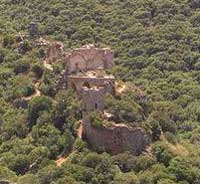 An interesting site that is roughly in between Nahariya and Ma'alot isMontfort Castle, a fortress built by French Crusaders. Like many such castles, it changed hands between Saladin's army (in 1187) and otherCrusaders (1192). German Knights of the Teutonic Order bought the fortress, translated the French name (which means "strong hill") to Starkenberg, and further fortified it, but it wasconquered nevertheless by the Mamluk Sultan Baybars in 1271 who, in a rare show of humanity for that age, allowed the inhabitants to leave with their possessions. It's a good half-hour hike to the castle and there are a number of trails for longer hikes in the surrounding countryside.
Nahariya & Ma'alot
Less than 10 miles north of Acre is the town of Nahariya.
On the way, you can visit Kibbutz Lohamei HaGhettaot ("The Ghetto Fighters"). This kibbutzwas founded in 1949 by survivors of the Holocaust, mostly from Poland and Lithuania. The kibbutzmaintains a wonderful museum and archive dedicated to the Holocaust and Jewish resistance.
Nahariya itself is a resort town, which was founded by German Jews in 1934. Yet more beautiful beaches can be found here, along with great conditions for sailing and windsurfing (the world championships were held there in 1980). The city also has a fine museum of art and archaeology and visitors can enjoy rides in horse-drawn carriages.
In the 1940s, Nahariya was a landing spot for illegal immigrant ships. Instead of refugees, missiles landed in the city in the 1980s when it became a target of Katyusha rockets fired by Palestinians in Lebanon in what became the Lebanon War. Today, the city of roughly 30,000 people is a popular place for UN peacekeeping troops from Lebanon to go for R&R.
A little beyond the city limits is the beach at Akhziv, which is part of a national park. This was once an important settlement and station on the ancient coastal road that linked Egypt and Phoenicia. Jews have lived here since the Second Temple period. The Crusaders built a castle here and called it Le'imbert.
Opposite the water is a hill on which Kibbutz Haziv sits. The kibbutz is one of the largest turkey breeders in the country. It is more famous in Israel for its association with an incident during the British mandate. In June 1946, the Haganah simultaneously blew up 11 bridges linking Palestine with neighboring Arab countries. One team was to blow up the Achziv bridge, but was spotted by British soldiers who fired on them. One of the bullets inadvertently hit the explosives the Jews were carrying and set them off. The explosion blew up the bridge, but killed 14 men as well.Ma'alot
Ma'alot is an immigrant town 11 miles east of Nahariya was founded in 1957. This small town made world headlines when a group of 11th graders on a field trip from Safed spent the night in a school in Ma'alot. On May 15, 1974, three PLO terrorists disguised in Israeli uniforms, who had infiltrated from Lebanon, killed the school children's guard and stormed the building. Some children were killed as the terrorists entered, others escaped through a window on the second floor. The terrorists threatened to kill the remaining children unless Israel released Arab terrorists held in Israeli prisons. Israel's official policy was not to negotiate with terrorists, but the government decided to ask for more time to talk. The terrorists rejected the request. Fifteen minutes before the terrorist-imposed deadline for starting to kill their hostages, an elite Golani brigade unit mounted a rescue operation. When it was over all the terrorists were dead, but so were 21 children who had been murdered by the Arabs.In 1963, Ma'alot merged with Tarshiha, a 900-year-old neighboring Muslim and Christian Arab village to form a single municipality. This a rare model of interdependence and cooperation between Jews and Arabs. Today, the population is approximately 17,500; 13,000 in Ma'alot, 4,500 in Tarshiha.Crusader Fortresses
An interesting site that is roughly in between Nahariya and Ma'alot isMontfort Castle, a fortress built by French Crusaders. Like many such castles, it changed hands between Saladin's army (in 1187) and otherCrusaders (1192). German Knights of the Teutonic Order bought the fortress, translated the French name (which means "strong hill") to Starkenberg, and further fortified it, but it wasconquered nevertheless by the Mamluk Sultan Baybars in 1271 who, in a rare show of humanity for that age, allowed the inhabitants to leave with their possessions. It's a good half-hour hike to the castle and there are a number of trails for longer hikes in the surrounding countryside.
If you're into Crusader fortresses, you might also want to visit Yehi'am (Judin) Castle, which is less than eight miles east of Nahariya. This was probably built around the 12th century to guard the road from Akko into Lebanon. As in the case of Montfort, the Teutons took over the castle in the 13th century and lost it a few decades later to the Mamluks. It was used into the eighteenth century by the Bedouin ruler Dahar El-Amer, who conquered the Galilee.
Jewish settlers came to the area in 1946 and established a kibbutz, which was named after Yehiam Weitz, a member who was killed during an operation against the British in which the Akhziv Bridge was blown up. A visitor in 1940 gives a sense of the conditions the Jews encountered, "The fortress is in ruins but it stands in a beautiful place and dominates the surroundings. There is no water, only empty cisterns. The soil is hard but some of it can be cultivated, adn there is no road...."
When the UN voted to partition Palestine in 1947, Nahariya and several other Jewish settlements were in the territory assigned to the Arab state. The western Galilee was cut off from the Jews inHaifa and it its suburbs and these northern settlements were isolated from each other. Yehi'am was one of these isolated outposts. On March 26, 1948, a convoy of home-made armored trucks bringing supplies and reinforcements to Yehi'am from Haifa was ambushed by Arab gangs and 47 of the Haganah fighters were killed in the ensuing battle. Later, in May, a convoy broke the Arab blockade. Today, a monument stands at the junction where the convoy battle was fought, with burnt cars and trucks left as a reminder of the carnage.
Though it's not on most tourists' itineraries, the Tefen Industrial Park, a short drive from Ma'alot, is also a fascinating place to visit. No, it's not a collection of factories; well, not exactly. Actually, it is a kind of cooperative incubator for new businesses founded by industrialist Stef Wertheimer. The industrial park was designed to help innovative and creative people start businesses with the advantage of sharing the cost of much of the infrastructure and many services. What really sets Tefen apart, however, is Wertheimer's view of the interrelationship between artistic and entrepreneurial creativity. The park is filled with sculptures and gardens. It also has an art museum, a museum of German Jewry and an exhibition of vintage cars.
 The book of Joshua (13:6) mentions "Misraphot Mayim" south of Rosh Hanikra, as the border of the Israelite tribes during the 14 -13 centuries BCE. Jewish sages referred to the cliff as "The Ladder of Tire." The Muslimconquerors renamed the area A-Nawakir (the grottoes). The present name, Rosh Hanikra, is a hebraicized version of the Arabic Ras-A-Nakura.
 The British army invaded Lebanon from this direction during the two world wars as did Israeli forces in the late 70's and early 80s. During World War II, the British dug a tunnel for the railway running between Haifa and Beirut to facilitate the movement of supplies from Egypt to the north. When the British withdrew in 1948, Israeli forces took over Rosh Hanikra and the Palmach blew up the railway bridges in the grottoes to prevent the Lebanese army from invading from that direction when the War of Independence began. During the Lebanon War, you could watch lines of Israeli tanks along the border preparing to cross and jeeps with UN peacekeepers observing the movements.
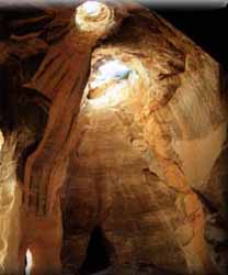
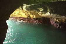
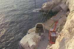 The grottoes of Rosh Hanikra were formed by the sea chipping away portions of the soft chalk rock over thousands of years. In 1968, a tunnel was dug from the shore to the natural grottoes. The tunnel was constructed slightly above the sea surface. It is 400 meters long and took two years to complete. A cable car leads to the shoreline where visitors can explore the grottoes. It is possible, though not advised, to swim in the grottoes, which are inhabited by bats, loggerhead sea turtles, sea birds and other wildlife. The place is a part of the Achziv Natural Reserve.
Rosh Hanikra
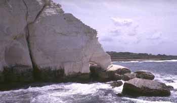 |
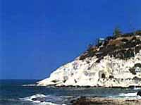
Rosh Hanikra is in the northwestern corner of Israel, on the border of Israel and Lebanon.
The white chalk cliffs offer a spectacular panoramic view of Haifa Bay, the hills of the Galilee and the Mediterranean Sea.
The book of Joshua (13:6) mentions "Misraphot Mayim" south of Rosh Hanikra, as the border of the Israelite tribes during the 14 -13 centuries BCE. Jewish sages referred to the cliff as "The Ladder of Tire." The Muslimconquerors renamed the area A-Nawakir (the grottoes). The present name, Rosh Hanikra, is a hebraicized version of the Arabic Ras-A-Nakura.
In ancient times, Rosh Hanikra was along the trade route between the northern civilizations in Lebanon and Syria and the southern ones in Palestine, Egypt and North Africa. The place was then known as "the Ladders of Tyre." It has been the gateway in and out of Palestine since ancient times. In 333 Alexander the Great entered the Land of Israel through Rosh Hanikra, and is believed to have led his Greek army through a tunnel his forces dug in these cliffs.
The British army invaded Lebanon from this direction during the two world wars as did Israeli forces in the late 70's and early 80s. During World War II, the British dug a tunnel for the railway running between Haifa and Beirut to facilitate the movement of supplies from Egypt to the north. When the British withdrew in 1948, Israeli forces took over Rosh Hanikra and the Palmach blew up the railway bridges in the grottoes to prevent the Lebanese army from invading from that direction when the War of Independence began. During the Lebanon War, you could watch lines of Israeli tanks along the border preparing to cross and jeeps with UN peacekeepers observing the movements.The grottoes of Rosh Hanikra were formed by the sea chipping away portions of the soft chalk rock over thousands of years. In 1968, a tunnel was dug from the shore to the natural grottoes. The tunnel was constructed slightly above the sea surface. It is 400 meters long and took two years to complete. A cable car leads to the shoreline where visitors can explore the grottoes. It is possible, though not advised, to swim in the grottoes, which are inhabited by bats, loggerhead sea turtles, sea birds and other wildlife. The place is a part of the Achziv Natural Reserve.
The Golan Heights
SITES & INFORMATION:
Overview
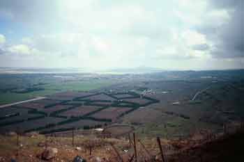
The Golan Heights rise from 400 to 1700 feet in the northeastern section of the country. Israel's highest mountain, Mt. Hermon, is located here. The plateau was once actively volcanic and the northernmost points remain weathered and desolate. The Golan overlooks the Hula Valley, Israel's richest agricultural area. The area of the Golan is roughly 38 miles long and varies in width from 9 to 16 miles (444 square miles). The Banyas River flows through the region and the Yarmuk River separates the Golan from Jordan.
The Golan appears to have been used as a cemetery in ancient times. Archaeologists have discovered funerary monuments that are about 4,000 years old. The area was not settled until the days of Herod the Great in the first century B.C.E.
During the Ottoman Empire (1517-1917), the Golan was under Syrian administration. When the British defeated the Turks in World War I, they dismantled their empire and, with the French controlled the region. When Syria won its independence in 1946, it regained control of the Golanand, within a few years emptied the region of the sparse population of Bedouin and Druze, and turned it into a military encampment from which to harass Israel.
Military Importance
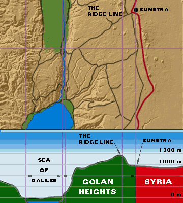 |
The Golan is a strategically important region, extending like a finger between the borders ofLebanon, Jordan and Syria. In the past, that finger was crucial to preventing the Israeli defense dike from bursting and allowing Arab armies to flood the country. Why? Because it is only about 60 miles -- without major terrain obstacles -- from the westernGolan to Haifa and Acre, Israel's industrial heartland. In the hands of a friendly neighbor, the escarpment has little military importance. If controlled by a hostile country, however, the Golanhas the potential to again become a strategic nightmare for Israel.
From 1948-67, when Syria controlled the Golan Heights, it used the area as a military stronghold from which its troops randomly sniped at Israeli civilians in the Hula Valley below, forcing children living on kibbutzim to sleep in bomb shelters. In addition, many roads in northern Israel could be crossed only after probing by mine-detection vehicles.
Israel repeatedly, and unsuccessfully, protested the Syrian bombardments to the UN Mixed Armistice Commission, which was charged with policing the cease-fire, but nothing was done to stop Syria's aggression. Meanwhile, Israel was condemned by the UN when it retaliated.
Today, you can visit former Syrian bunkers to see the view their gunners enjoyed of the valley below. This will give you an appreciation of the strategic value of the Golan that you cannot get without seeing it for yourself. Be sure to stay on the well-worn paths, because old Syrian mine fields remain uncleared beyond them.
War in the Golan
After the Six-Day War began, the Syrian air force attempted to bomb oil refineries in Haifa. While Israel was fighting in the Sinai and West Bank, Syrian artillery bombarded Israeli forces in the eastern Galilee, and armored units fired on villages in the Hula Valley below the Golan Heights.
Israel Fact
A great view of the Hula Valley is afforded from the Hill of the Twenty-Eight, an old British fortress captured by the Haganah at a cost of 28 lives. When efforts to dynamite the building failed, the group’s commander strapped the dynamite to his back, ignited it, and threw himself at a weak point in the wall.
|
On June 9, 1967, Israel moved against Syrian forces on theGolan. By late afternoon, June 10, Israel was in complete control of the plateau. Israel's seizure of the strategic heights occurred only after 19 years of provocation from Syria, and after unsuccessful efforts to get the international community to act against the aggressors.
Six years later, in a surprise attack on Yom Kippur, the Syrians overran the Golan Heights before being repulsed by Israeli counterattacks. After the war, Syria signed a disengagement agreement that left the Golan in Israel's hands. Israel returned the city of Kuneitra to Syria, and a UN-patrolled buffer zone was created between the two armies.
On December 14, 1981, the Knesset voted to annex the Golan Heights. The statute extended Israeli civilian law and administration to the residents of the Golan, replacing the military authority that had ruled the area since 1967.
U.S. officials have persistently and unsuccessfully tried to mediate a final peace agreement between Israel and Syria. Today, as the peace process with the Palestinians progresses, there is new hope that negotiations with Syria will bear fruit.
Life in the Golan
 |
After Israel annexed the Golan, the Druze living in five villages in the north were given the choice of becoming citizens. Many accepted the offer, but some chose to be recognized as "Syrians abroad."
The Israeli government has made a conscious effort to encourage Jews to settle in the Golan, but the majority of the population remains non-Jewish. Several kibbutzim are located in the region.
If you follow the main road, Route 98 to the end, past the fields and orchards of the Jewish farmers, you'll reach the border. Actually, the borders between Israel and Syria remain subject for negotiation, so the two countries are separated by a demilitarized zone patrolled by the U.N.Disengagement Observer Force (UNDOF). In that zone is the deserted city of Kuneitra, which lies in the "Valley of Tears" where one of the bloodiest battles of the Yom Kippur War was fought. A great lookout to see the Heights, and especially the Syrian side of the border, is from the now abandoned Israeli bunker 4,000 feet (1,200 m.) above sea level on Mount Bental. You can walk underground and see what accommodations were like for the soldiers manning the outpost. Another good place to view the Golan is from the former Syrian fortification at the Golani Look-Out Post (Mizpe Golani) at Tel Faher.
The Banyas Spring
A far more scenic and fun place to visit is the Banyas Springs Nature Reserve. The Banyas is another source of the Jordan River. The area was first settled around the 3rd century B.C.E. and, during the year 2 B.C.E., became the capital of a Roman kingdom. The town later became an important Christian center and is referred to in the New Testament as the place where Jesus determined that Peter would be "the rock" on which the church would be built. The name is derived from the Greek Paneas, (after the god of fertility, Pan). Since Arabic doesn't have a "p" sound, it was changed toBanyas in Arabic. Today, the Banyas are a great place to hike to see waterfalls and to go river rafting.
In the center of the Golan is Katzrin, a government-planned town where many army officers stationed in the area settled. The town has an interesting museum of regional history. It is also the site of an ancient synagogue that is particularly interesting because the entrance faces north rather than south as in the typical synagogue. Also, nearby is a winery where you can sample some of the best Israeli wines.
About six miles from Katzrin is another of the fascinating strongholds of early Jewish history. Gamla became home to Jewish refugees fleeing the Romans after the revolt broke out in 66 C.E. The Romans laid siege to the city, whose defenders heroically held out for some time before being overcome. Most of the Jews were killed, though many chose to jump off the cliffs to commit suicide rather than be captured. Gamla derived its name fromgamal (Hebrew for camel), since it was situated on a hill shaped like a camel's rump.Mount Hermon
Though Mount Hermon's highest peak is more than 9,000 feet high, the top elevation under Israeli control is Mizpe Shelagim, the "Snow Observatory," at about 7,300 feet (2,224 m.). U.S. observers have a base on the mountain, and both Israel and Syria have observation posts. For a really unusual Israel experience, you can try skiing on Mount Hermon during the winter months (roughly December-April). The longest run is more than a mile, but experienced skiers will not mistake the mountain for Aspen. A lift for non-skiers goes to the summit and affords a spectacular view of the surrounding area.
A good view of Mount Hermon can be had at Berekhat Ram (Ram Pool), a small, shallow lake in he crater of a dormant volcano. The lake has some fish, which are caught by local Druze fisherman. In the summer, it is also a pleasant recreational area for swimming and picnicking.
Israel Fact
According to tradition, God made Nimrod lord of all creatures. Nimrod's head swelled with self-importance. He asked why he should sacrifice to God and shot arrows into the sky. God sent the arrows back covered with blood leading Nimrod to believe he had defeated God. But the Lord spoke: "Wicked one, I have a tiny creature down there in my world, a mosquito. Go and do battle with it!" Nimrod went to fight the mosquito, but it flew up his nose to his brain where it buzzed until Nimrod died. To this day, swarms of mosquitoes can be found in the area.
|
Another interesting archaeological site is Mivzar Nimrod, a 12th century Crusader castle that allowed its ruler to control traffic between Lebanon and Tiberias and the Jordan Valley. The fortress exchanged hands between Christians and Muslims for some time and was held for some time by a radical Muslim sect known as the Hashishin. This group was known for smoking hashish and murdering their enemies. The word "assassin" is derived from this sect.
Driving through the Golan, you see beautiful mountains, rocky hillsides, green valleys and wild flowers. You can also find spectacular waterfalls off the main roads near Gamla and below Nimrod's Castle. Of course the falls are only in full force during winter and early spring; by summer, many of them dry up.The Upper Galilee
The Hula Valley was once a marshland. Israel drained it to eradicate malaria and make room for more people to live and farm after independence. Wildlife once thrived in the area, but the ecosystem was seriously harmed by the effort to make it more habitable. In recent years, Israel has tried to partially reverse the damage by reflooding a small part of the region.
Parts of the valley have begun to recover and wildlife is returning. Even this is a mixed blessing, however, as the Israeli desire to promote tourism in the area conflicts with environmentalists' efforts to better protect the area. For now, the Hula Nature Reserve offers places to see birds and other animals. You can also go kayaking nearby in the Jordan River.Israel Fact
"It is good to die for our country" -- last words of Joseph Trumpeldor.
|
In the upper Galilee, you'll find a number of interesting towns and villages. The largest is Kiryat Shmona (pop. 18,000). The town takes its name, which means "Town of the Eight," from the heroic Zionist, Joseph Trumpeldor, who, together with seven other defenders, was killed in a last-ditch battle against Arab marauders at the nearby settlement of Tel Hai in 1920. In recent years, Kiryat Shmona has gotten publicity mainly for being a target of katyusha rockets fired from Lebanon by Hezbollah.
Israel's northernmost village, at the border of Lebanon and foot of Mt. Hermon, is Metulla. This picturesque town was established in 1896 on land purchased from a Lebanese Christian. Today, approximately 1,100 people live in Metulla, which is known for the Canada Centre where visitors can find squash and basketball courts, a firing range, swimming pool, ice rink and other sports facilities. Just west of the town is the “Good Fence,” a border crossing where some Lebanese are allowed to enter Israel for work and medical care. The crossing's name originated in 1976, when a Lebanese child was allowed to come to Israel for medical treatment.
A little more than a mile from Kiryat Shmona is Tel Dan, site of another nature reserve and an important archaeological dig. The city dates back nearly 4,000 years to the days of Canaanite rule. As a border town of the kingdom of Israel along the main trade route between Damascus and the Galilee, and the Dan River, one of the three main sources of the Jordan River, Dan was an important strategic outpost. Consequently, it became a battleground between Israelite forces and invaders from the north, such as the Assyrians. Today, the area is a nature reserve filled with poplars, eucalyptus, oak, pistachio and many other varieties of trees, ferns and flowers. Nearby Be Ussishkin is a museum that tells the story of the Hula Valley and the Hermon.
Safed
This city's name is spelled so many different ways -- Tzefiya (in the Talmud), Safad, Zefat, Sefad -- it's easy to get confused and think they are entirely different places.
Regardless, if you see any of these on your itinerary, it's a place you'll want to visit.
At an altitude of 2,790 feet (850 meters), Safed is Israel's highest town and probably its coldest.
Safed did not become an important center of Jewish life until the late 15th and early 16th centuries. It is not mentioned in the Torah and was apparently not settled until Roman times.
The Crusaders erected a citadel in the city, which, like most of their other structures, came under the control of the Muslim conqueror Saladin in the late 12th century. The Crusaders returned a half-century later and built the largest Christian fortress in the East, but that eventually fell to theMamluks in 1266 under Sultan Beibars, who cut off the heads of the men and sold the women and children into slavery.
Jews began to come in large numbers after they were expelled from Spainin 1492 (while Columbus was sailing the ocean blue). The city is most closely associated with Jewish mysticism, the kabbalah, whose foremost exponent, Rabbi Isaac Luria, lived and taught there. Known as "Ha'Ari" (the lion), Luria had come from Egypt in 1569 and died just three years later. The "bible" of the kabbalists, the Zohar, was written by the second-century talmudist Rabbi Shimon bar Yochai, who believed each word and line of the Torah had a higher meaning. The author of the main part of the Zoharwas Moses de Leon (12th century) in Spain.
Besides the kabbalists, Safad also attracted numerous other Jewish scholars and spirtualists, including Joseph Caro, the author of the Shulchan Aruch, Rabbi Moshe Cordovero and Solomon Alkabetz, composer of the Sabbathhymn Lecha Dodi.
The Jewish community thrived in Safed for more than 400 years before the outbreaks of violence in Palestine provoked many residents to leave. The1929 Arab riots stimulated a gradual decline that resulted in the Arabs becoming the majority in the city. When the British withdrew from Palestine in 1948 and handed the Citadel over to the Arabs, the remaining Jewish residents, backed by reinforcements from the Haganah, held off the Arab forces and kept the city a part of the new state of Israel.
The city is a warren of cobblestone streets that lead to ancient synagogues. In the Caro Synagogue, named after the scholar, the Ark contains a Torah scroll that is at least 400 years old. Many of the doors of buildings in the city are painted blue to remind people of heaven.
Another pilgrimage site, just outside Sefad, is the village of Meron. This ancient city is mentioned in the records of Egyptian kings who invaded the territory more than 3,000 years ago. A synagogue dating back 1,700 years was also found here. According to tradition, Rabbi Shimon bar Yochai hid in a cave in nearby Peki’in and wrote the Zohar. Though one Jewish family claims to have lived in the town since the days of the great Rabbi, today Peqiin is almost entirely populated by Druze.
On Lag Ba'Omer, thousands of Israelis hike up Mt. Meron (alt. 4,000 ft.) to the tombs of Rabbi bar Yochai and his son Eleazer. People come to honor the rabbi, who is said to have died on this date, and many have picnics and go into the forest with bows and arrows. The following morning, three-year-old boys are given their first hair cuts. Meron is also the final resting place for the two great Talmudic sages, Hillel and Shammai.
Down the Sefad road is the town of Rosh Pina, a name that means "cornerstone," which comes from Psalm 118: "The stone that the builder has rejected has become the headstone of the corner."
You can also contribute to the greening of Israel by visiting the Jewish National Fund's Tree Planting Center just outside Safed. For a small fee, you can plant a sapling, a tangible contribution like no other you can make to Israel.
A tyrannical Arab governor of Sefad ordered the Jews to bring him a certain number of white chickens or face expulsion. The Jews went to the grave of Rabbi Yossi Banai and prayed. Miraculously, all the chickens in the town turned white.
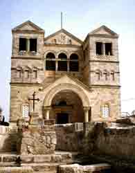 About six miles southeast of Nazareth stands Mt. Tabor, a dome-shaped mountain rising nearly 2,000 feet above the Jezreel Valley. From the camp at Mt. Tabor around 1150 B.C.E., Deborah and Barak led the armies of Israel in the battle agains Sisera, the Canaanite general (Judges 4:12-16). This was also the site of a thriving Jewish community which constructed a fort there during the Second Temple period.
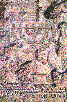
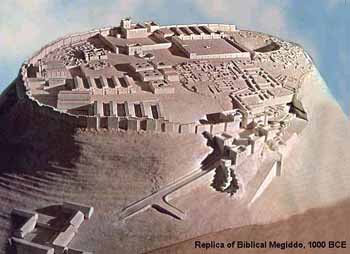 Megiddo is first mentioned in the Bible in Joshua 12:21. At the time the city was inhabited by Canaanites. The city later came under the control of King Solomon, though there is some controversy as to how much of a connection he had to the remains that have been discovered. The Israelite connection to the city ended around 732 B.C.E. when theAssyrians conquered Palestine. Though the city was destroyed and rebuilt several more times, it gradually declined in significance. Most recently, Megiddo was the place where British General Edmund Allenby launched his attack against the Turks in 1917. It also served as a base for Israeli forces in the 1948 war.
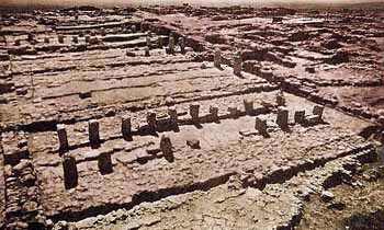 One of the interesting parts of the excavation is the chariot stables, called Solomon's Stables even though we now know they were built by King Ahab during the 9th century B.C.E. The only parts that remain are the posts where the horses were apparently tied and troughs. A grain silo dates from the reign of King Jeroboam in the 8th century B.C.E.
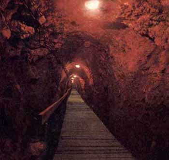 Today, water is considered vital to the security and survival of Israel. That this has been true since ancient times is evident in many archaeological sites throughout the country, including Megiddo. Here, an ingenious system was devised so the townspeople would not have to leave the safety of the city walls to collect water. A vertical shaft was dug within the city to the depth of the nearby spring and then a tunnel was built connecting to the water source. You can walk down 183 steps into the shaft, which is 120 feet deep, and then along the tunnel, which stretches another 215 feet.
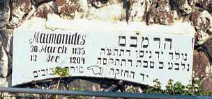 After his death in 1204, the great Jewish sage Maimonides was buried in Tiberias. His tomb is on Ben Zakkai Street, a short distance from the town center. The street's namesake, RabbiYochanan ben Zakkai, is also believed to be buried nearby. Yet another shrine is the Tomb of Rabbi Akiva.
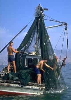 Tiberias sits along the 32-mile shoreline of the Sea of Galilee. The Sea lies roughly 650 feet below sea level and is 14 miles long and 7 1/2 miles wide at its widest point. The Sea is the major source of fresh water for the entire country. The Sea, really a lake, lies on the ancient "Via Maris," a route that linked Egypt and Mesopotamia.
 Just outside of Tiberias is the ancient town of Hammat, which boasts the hottest (140º) mineral springs in Israel and has, not surprisingly, become a popular spa. The town also has a synagogue built in 341, that has a magnificent mosaic floor. It is unusual, in part, because it contains human figures that are nude. This is rare because synagogues rarely have human representations in them and, when they do, they are fully clothed.
About two miles south is Capernaum (Kfar Nahum), the lakeside town where Jesus preached, and his disciples, Peter and Andrew lived. This is where Jesus told his followers, "Follow me, and I will make you fishers of men." He spent three years based here and performed many miracles, but was rejected by the townspeople, provoking Jesus to curse them, "And thou, Capernaum, which art exalted unto Heaven, shall be brought down to hell!"
 The Jordan River also passes near Kibbutz Kinneret. Perhaps you have an image of the Jordan as a mighty body of water like the Mississippi, an understandable expectation given its role in history and scripture. In fact, it is more like a muddy stream that is only a few feet wide in places. Since Jesus was baptized by John in the river (near Jericho), it has become traditional for Christian pilgrims to come to a special park along the river established as a baptism site.
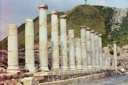 It was at nearby Mt. Gilboa that King Saul was wounded in an epic battle with the Philistines in the 10th century B.C.E. Rather than allow himself to be captured by the victorious Philistines, Saul chose to fall on his sword. The Philistines then cut off his head and hung his body, and that of his sons on the city walls (I Samuel 31:9). Today, Bet She'an's main street is named after the King.
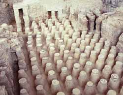 The city was destroyed by a massive earthquake in 749 and archaeologists are still uncovering the remains of the ancient civilizations. Among the finds are a huge (1 1/2 acres) Byzantine bath house, a Roman temple and colonnaded streets paved with basalt stones. The most impressive of the ruins is the Roman Theater, which was built around the year 200. Built to accommodate roughly 8,000 people, the theater has a stone stage and was used for dramatic productions.
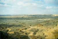 The gateway to the Negev is a place that once was little more than a watering hole for Abraham's sheep. Today, Beersheba is a modern city of 130,000. Further south is Kibbutz Sde Boker, where Ben-Gurion made his home. Today, the hut where he lived is a museum devoted to his legacy.
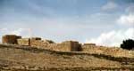 The Eastern Negev has two of the area's larger towns. The first is Arad, a development town that serves as a convenient stopover for visitors to the Dead Sea and Masada. The town is also popular because of its clean, dry air, which makes it a haven for people suffering from asthma and allergies. Nearby is Tel Arad, site of a biblical town that is one of the earliest known urban settlements.
 Further south, on the way to Eilat is Dimona, a town established in the 1950s to help absorb Jewish inmigrants. Originally considered too remote and its climate too unpleasant for large-scale settlement, the town has grown to be a thriving community of more than 20,000. It is best known, perhaps, as the site of Israel's nuclear research program and is believed to be the site where nuclear weapons have been developed. It is also known as the home of the Black Hebrews, a sect that originally came from Chicago and settled in Dimona.
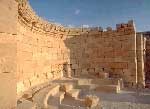 Mamshit was annexed by the Romans in 106 C.E. and the town was renamed it Memphis. The town grew for several centuries until being abandoned after theMuslim conquest in 636. During the Byzantine era, three churches were constructed and the remains of some of the mosaics are still visible as are parts of the Roman city walls. In one room archaeologists found a bronze jar filled with 10,000 silver coins dating from the first and second centuries.
A tyrannical Arab governor of Sefad ordered the Jews to bring him a certain number of white chickens or face expulsion. The Jews went to the grave of Rabbi Yossi Banai and prayed. Miraculously, all the chickens in the town turned white.
Nazareth & Surroundings
PLACES TO VISIT:
Nazareth
Nazareth is the largest Arab city in Israel, with a population of 60,000, once split nearly evenly between Christians and Muslims, but now nearly two-thirds Muslim. The two groups have lived harmoniously, though a dispute erupted in 1999 over the desire of Muslims to build a mosque near a church.
Nazareth was apparently never an important site in Jewish history; it is not mentioned in the Old Testament or rabbinic literature, though Jews certainly lived there in Jesus' time. The first reference is in the New Testament (John 1:45) and, even there, the town is referred to in a negative way ("Can there any good thing come out of Nazareth?" 1:46)
For Christians, Nazareth is important because it is the place where Jesus spent much of his life. The Church of St. Joseph's Carpentry contains ruins dating to the 1st century, and is revered as the original workshop of Joseph and home of the Holy Family. The site actually was abandoned for many years until Franciscans bought it in 1754 and set up a chapel dedicated to Joseph. The church there today was built above the ruins of a 13th century Crusader church.
 |
Nazareth also has several other important churches, the Synagogue-Church, where Jesus preached (Luke 4), Gabriel's Church, which Greek Catholics believe to be the site of the Annunciation and the Mensa Christi ("Table of Christ") Church, where Jesus is said to have dined with his Apostles after his Resurrection.
The Basilica of the Annunciation is the place where, according to Christian tradition, the angel Gabriel appeared before Mary, saying: "Behold, thou shalt conceive in thy womb, and bring forth a son, and shall call his name Jesus" (Luke 1:26-35).
The Church, the largest house of Christian worship in the Middle East, has been controlled by the Muslims since Saladin's conquest in 1198. When the Ottoman Turks captured the city in the 16th century, they expelled all the Christians. They were not allowed to return until the reign of the Emir of Lebanon, Fakhr ad-Din II (1590-1635). The present building took nearly a decade to build before being completed in 1969 over the remains of earlier structures dating to the Byzantineperiod.
The Greek Orthodox have their own Church of the Annunciation where they believe Gabriel appeared to Mary. This church was built nearly three centuries ago over the well where Mary is said to have drawn water.
When Jesus left Nazareth, he performed his first miracle, changing water into wine at Cana (John2:11, 4:46), now the Arab village of Kafr Kana, ten minutes up the Tiberias road.
The Muslims have built seven mosques in Nazareth, the largest, the Peace Mosque, was built in 1963. The el-Abyad Mosque, to the north of the Basilica of the Annunciation, was built in 1812, and is the oldest in the city. A dispute arose when Muslims in Nazareth proposed building a mosque next to the Basilica of the Annunciation in 1997. Initially, the Israeli government agreed to allow construction, but the decision was protested by Christian leaders. Ironically, Jews essentially became referees in a five-year religious tug-of-war between Muslims and Christians. In the end, a government committee announced in 2002 that the mosque should not be built.
Jews have also begun to settle in the city. Nazareth Illit (Upper Nazareth) is a relatively new town that has become a popular home for new immigrants from the former Soviet Union.
Mt. Tabor
About six miles southeast of Nazareth stands Mt. Tabor, a dome-shaped mountain rising nearly 2,000 feet above the Jezreel Valley. From the camp at Mt. Tabor around 1150 B.C.E., Deborah and Barak led the armies of Israel in the battle agains Sisera, the Canaanite general (Judges 4:12-16). This was also the site of a thriving Jewish community which constructed a fort there during the Second Temple period.
The mountain is holy to Christians who believe it is the site of the Transfiguration of Jesus (Luke 9:28-36). During the Byzantine and Crusadereras, several monasteries were build on the mountain, which were subseqently destroyed by Arab conquerors. The Basilica of the Transfiguration was built in the 1920s over the ruins of older churches. The Greek Orthodox Church of Elias is also on the summit.
The sometimes windswept peak affords a spectacular view of the valley and, on a clear day, it is possible to see the Mediterranean, the Sea of Galilee and Mount Hermon.
The Gospel Trail
The Gospel, or Jesus, Trail offers pilgrims and tourists, individuals and groups, the opportunity to discover the cradle of Christianity by experiencing – both physically and spiritually – the same biblical landscapes and sites of the Galilee where Jesus and his disciples once walked. The Gospel Trail incorporates over 60 kilometers (40 miles) of specially-signposted footpaths and roads which can be traveled on foot, by bicycle and/or car, culminating in the spiritual highlight of sailing on the Sea of Galilee.
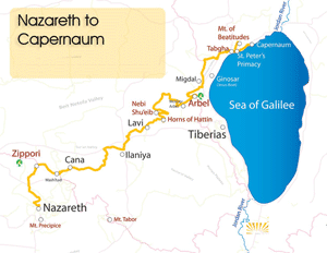 |
The modular trail, which became fully open to the public in November 2011, follows historical routes and paths that Jesus is believed to have taken when he left Nazareth, the home of his childhood, for Capernaum on the northwestern shore of the Sea of Galilee, which became the center of his ministry. Luke 4: 29 -31: “And they led him to the brow of the hill on which their city was built, that they might throw Him down over the cliff. Then passing through the midst of them, he went his way. Then he went down to Capernaum, a city of Galilee…”
The main section of the trail, which begins at Mount Precipice, includes Jezreel Valley, Beit Qeshet Oak Reserve, along the Arbel Mountain through Magdala, Tabgha and Capernaum. Secondary routes of the Gospel Trail will take visitors to Mount Tabor and the Church of the Transfiguration, Kafr Kanna, the Horns of Hitim, Mount Arbel, and the Mount of Beatitudes. All of these routes will end at the main destination at the Capernaum center, where Gospel Trail walkers will be able to continue their spiritual journey on the Sea of Galilee itself. A special dock has been constructed, and there will be areas for prayer and inspirational solitude on the shoreline.
The Israel Tourism Ministry in cooperation with KKL-JNF invested more than $700,000 in the Gospel Trail's infrastructure. This includes unique signage hewn into basalt rocks that blend into the natural landscape and feature the relevant scripture readings for the site, safety barriers, shaded rest areas, stone benches, picnic sites and tourist information.
Zippori
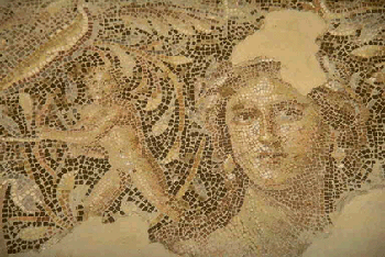 |
The city of Zippori (Sepphoris) is located on a hill in the Lower Galilee, midway between the Mediterranean and Lake Kinneret (Sea of Galilee).
The city dates to the era of the Maccabees in the second century B.C.E., when it was founded by Alexander Janneus of the Hasmonean dynasty.
Zippori was described by the first century C.E. Jewish historian, Josephus Flavius, as "the ornament of all Galilee." The city may get its name from the Hebrew word "tsipor" (bird) because the view from the town gives a sense of flying.
Zippori is mentioned in many Jewish sources of the first centuries of the common era. Founded in the Hellenistic era by Alexander Janneus, it was captured by the Romans in 37 B.C.E. when the inhabitants fled in the midst of a snowstorm. A rebellion against Herod's control of Zippori was suppressed and the King's son, Herod Antipas rebuilt the city and renamed it Autocratoris. The Roman governor, Gabinius, later made Zippori the administrative capital of Galilee in the mid-first century B.C.E.
The Jews did not join the revolt against Rome in 66 C.E.; instead, they opened the city gates to the legions of the Roman Emperor Vespasian and surrendered. On coins minted in Zippori at that time, the city is named Eirenopolis, "city of peace." Later, its name was changed to Diocaesarea in honor of Zeus and the emperor.
The Jewish community grew when thousands of refugees from Judea moved to towns in the Galilee following the Bar-Kokhba revolt of 135 and Zippori became the center of Jewish religious and spiritual life in the Land of Israel. Rabbi Yehuda Hanasi, who compiled the Mishnah, lived in the city for 17 years and relocated the Sanhedrin (the supreme Jewish religious and judicial body he headed) to Zippori in the third century. At least 18 synagogues were functioning in the city around this time and Jews constituted the majority of the town's population.
Even after the seat of the Sanhedrin was moved to Tiberias, Zippori remained a center of Bible study and notable sages taught in its numerous academies. Also, its location on or near major trade routes in the lower Galilee, made Zippori a prime market for traders.
The discovery of rich, figurative mosaics during excavations at Zippori provide evidence of the Roman character of the city's pagan population, which coexisted in harmony with the Jews during the period of economic prosperity in the late Roman period. Zippori was destroyed in 363 by an earthquake, but was rebuilt soon thereafter, retaining its social and spiritual centrality in Jewish life in the Galilee.
The city is also the traditional birthplace of Mary and just four miles ofNazareth, the home of Jesus. During Byzantine times, the Christian community in Zippori grew considerably. This growth was accompanied by the construction of many churches and by Christian involvement in municipal matters. It became the seat of a Christian bishopric in the 5th century CE. Following the Arab conquest in the mid-seventh century, the city declined.
Under Crusader rule during the 12th century, a small watchtower and a church (dedicated to Anne and Joachim, parents of Mary, mother of Jesus) were built on the city's hilltop. The remains of the watchtower, partly renovated in later times, still dominates the hilltop today.
Since 1990, large areas of Zippori have been excavated. The finds have included public buildings and baths, residential areas, an amphitheater, market building, industrial installations, mikvot, cisterns, a complex drainage system and a great deal of glass. Of particular interest are the ruins of a 4,500-seat Roman amphitheater and a mosaic inside a villa that has the depiction of a beautiful young woman that is referred to as the "Mona Lisa of the Galilee." Archaeologists also discovered the narrowest ancient synagogue in Israel, measuring only about 68 feet (20.7 m.) long and 27 feet (8 m.) wide, which has a beautiful mosaic floor decorated with a zodiac and pictures of Temple objects and Biblical scenes.
Megiddo
Archaeologists working in Megiddo have unearthed an incredible 25 layers of settlement built on top of each other that cover a period of 35 centuries.
The city of Megiddo dates back roughly 8,000 years. The city ceased to exist after the Persian invasion of Palestine some 2,300 years ago and, today, nothing is left but the ruins of what once was a regional administrative and military center during the reign of King Solomon.
Israel Fact
To give a sense of the size of the community, when King Thutmose III of Egypt conquered Megiddo 3,500 years ago, he left with, among other things, 1,929 head of cattle, 2,000 goats, 20,500 sheep, 204 horses, 200 army uniforms, 502 bows.
|
Megiddo's long history is related to its strategic position overlooking theVia Maris, one of the main routes used for travel between Egypt, Syria and Mesopotamia. The city is referred to in the New Testament as Armageddon, a name St. John derived from the Hebrew for Mount Megiddo, Har Megiddo. According to the book of Revelation, this the place where the last great battle will be fought when the forces of good will triumph over evil.
The first people to inhabit Megiddo arrived during the Neolithic period. A watershed period occurred in the 20th century B.C.E. when it became a fortified city-state. Egypt later dominated the area then known as Canaan and massive walls were built around the city, which indicate Megiddo had become wealthy and required protection.
The first written reference to Megiddo; indeed, the first recorded battle in history, is a detailed account of the 1479 B.C.E. invasion of the Egyptian Pharaoh Thutmose III. The city subsequently became a center of culture and politics.
Megiddo is first mentioned in the Bible in Joshua 12:21. At the time the city was inhabited by Canaanites. The city later came under the control of King Solomon, though there is some controversy as to how much of a connection he had to the remains that have been discovered. The Israelite connection to the city ended around 732 B.C.E. when theAssyrians conquered Palestine. Though the city was destroyed and rebuilt several more times, it gradually declined in significance. Most recently, Megiddo was the place where British General Edmund Allenby launched his attack against the Turks in 1917. It also served as a base for Israeli forces in the 1948 war.One of the interesting parts of the excavation is the chariot stables, called Solomon's Stables even though we now know they were built by King Ahab during the 9th century B.C.E. The only parts that remain are the posts where the horses were apparently tied and troughs. A grain silo dates from the reign of King Jeroboam in the 8th century B.C.E.Today, water is considered vital to the security and survival of Israel. That this has been true since ancient times is evident in many archaeological sites throughout the country, including Megiddo. Here, an ingenious system was devised so the townspeople would not have to leave the safety of the city walls to collect water. A vertical shaft was dug within the city to the depth of the nearby spring and then a tunnel was built connecting to the water source. You can walk down 183 steps into the shaft, which is 120 feet deep, and then along the tunnel, which stretches another 215 feet.
Tiberias
SITES & INFORMATION:
Tiberias has been a popular destination for tourists for more than 2,000 years.
As early as Roman times, this thriving recreation spa, built around 17 natural mineral hot springs more than 600 feet below sea level, welcomed visitors from every part of the ancient world. Built by Herod Antipas (one of Herod the Great's three sons who divided up Palestine after their father's death), the city was named Tiberias in honor of the Roman Emperor Tiberius.
History
Tiberias plays an important role in Jewish history. It was part of the land bequeathed to Naphtali (Joshua 19:35). The Sanhedrin (the High Court of Israel during the period of the Second Temple) relocated to Tiberias from Sepphoris. In the Mishnaic and Talmudic period, Tiberias was an important spiritual center. The Mishna was completed in Tiberias in 200 C.E. under the supervision of Rabbi Yehuda Ha-Nasi ("Judah the Prince"). The Jerusalem Talmud was compiled in 400 C.E.
After his death in 1204, the great Jewish sage Maimonides was buried in Tiberias. His tomb is on Ben Zakkai Street, a short distance from the town center. The street's namesake, RabbiYochanan ben Zakkai, is also believed to be buried nearby. Yet another shrine is the Tomb of Rabbi Akiva.
A Samaritan center existed in Tiberias in the middle of the 4th century. The Crusaders later captured the city and made it the capital of the Galilee, but Saladin retook the city for the Muslim Empire in 1187. The city suffered a decline until it was revived by the Ottoman Turks. After the city was built up over a period of about a century, it was devastated by an earthquake in 1837.
The early Zionist pioneers established some of Israel's first kibbutzim at the turn of the century in this area. After the establishment of the state, newcomers flocked to the city and the population quadrupled. Today, it is home to about 30,000 people.
The Sea of Galilee
Tiberias sits along the 32-mile shoreline of the Sea of Galilee. The Sea lies roughly 650 feet below sea level and is 14 miles long and 7 1/2 miles wide at its widest point. The Sea is the major source of fresh water for the entire country. The Sea, really a lake, lies on the ancient "Via Maris," a route that linked Egypt and Mesopotamia.
The New Testament contains several references to the lake, which is known alternatively as the Sea of Galilee, Sea of Tiberias and the Sea of Gennesaret. This is where Jesus calmed the stormy sea (Mathew 8) and walked on the water (Mathew 14).
Israel Fact
The Sea of Galilee is shaped like a harp,kinnor in Hebrew, but this is not where the name of the lake comes from.
|
Israelis call the Sea by the biblical name Kinneret. This was the name of a city on the northwestern edge of the lake during the Canaanite and Israelite periods. The reference to the Sea of Tiberias is attributable to the newer riparian city.
Beyond the Sea
Just outside of Tiberias is the ancient town of Hammat, which boasts the hottest (140º) mineral springs in Israel and has, not surprisingly, become a popular spa. The town also has a synagogue built in 341, that has a magnificent mosaic floor. It is unusual, in part, because it contains human figures that are nude. This is rare because synagogues rarely have human representations in them and, when they do, they are fully clothed.
On the northeastern shore of the Sea of Galilee, you'll find the ancient fishing village ofBethsaida, the traditional home of Jesus' apostles Peter and Andrew. In this area, the Jordan River and several streams from the Golan Heights form a marshy delta that is home to a large variety of animals and birds, especially water-fowl.
 |
About six miles north of Tiberias, you can visit Kibbutz Ginosar, the former home of one of Israel's great statesmen, Yigal Allon. The kibbutz has a museum devoted to Allon's life and the history of the Galilee region. It also houses the so-called “Jesus boat,†a 2,000-year-old boat excavated from the Kinneret in 1985 that was probably used at the time of Jesus.
At the southern tip of the sea is Degania Aleph, Israel's oldest kibbutz, founded in 1909, and its nearby twin Degania Bet (built in 1920). Degania Aleph was named after its spiritual father, A.D. Gordon, and later was the birthplace of Moshe Dayan. Israeli Prime Minister Levi Eshkol came from Degania Bet.
When the Arab armies invaded Israel from the north in 1948, they ran over the settlements farther north in the Golan, but were stopped by the defenders of Degania Aleph. A French-made Syrian tank was left at the gate as a memorial to the battle.
At the opposite bank of the sea, is the country's second agricultural commune, Kibbutz Kinneret, which was established in 1911. Nearby is a cemetery, Ohalo, which not only is the final resting place for many of the people from the kibbutz, but also some of Israel's most famous personalities, including Rahel Bluwstein (known simply as Rachel to most Israelis), Ber Borochov and Moses Hess.
Sites of Christian Pilgrimage
Two miles north of Tiberias is the agricultural settlement of Migdal. This is near the ancient town where Mary Magdalene was born. Further north is the town of Tabgha, one of many sites in the Galilee where Christians of the early Byzantine period built monasteries, churches and shrines to commemorate the ministry of Jesus and the miracles ascribed to him. Tabgha is the traditional site of the Miracle of the Multiplication of the Loaves and the Fishes. (Matt. 14: 13-21). Nearby is the Mount of the Beatitudes. An Italian convent now stands on the hill. This is where Jesus is thought to have preached the Sermon on the Mount, which begins:
And seeing the multitudes, he went up into a mountain: and when he was set, his disciples came unto him: And he opened his mouth, and taught them, saying, Blessed are the poor in spirit: for theirs is the kingdom of heaven. (Matthew 5)
Standing on the church porch overlooking the Sea and the surrounding hills makes for a powerful setting to recall the sermon.
Also to the north
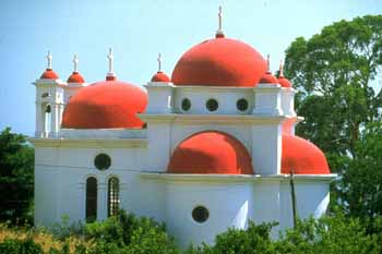 |
The synagogue may be on the site where Jesus preached, but was built two or three centuries later. We know it is a synagogue because of the Jewish symbols -- a menorah and a shofar -- inscribed on one of the columns.
The Jordan River also passes near Kibbutz Kinneret. Perhaps you have an image of the Jordan as a mighty body of water like the Mississippi, an understandable expectation given its role in history and scripture. In fact, it is more like a muddy stream that is only a few feet wide in places. Since Jesus was baptized by John in the river (near Jericho), it has become traditional for Christian pilgrims to come to a special park along the river established as a baptism site.
Bet She'an
When you drive south from the Sea of Galilee and cross the Jordan River, you enter the Bet She'an Valley, home of many kibbutzim and moshavim.
The Jordan River now forms the border between Israel and Jordan. The town of Bet She'an (pop. 15,000) is the site of spectacular archaeological excavations and a rich history, dating back to biblical times.
Bet She'an dates back to the Chalcolithic period (4th century BCE), when the town was an important stop for caravans and as a center of Egyptian rule. Excavations have uncovered a series of temples built by the Egyptians in honor of their local deities. Later, it became a Canaanite city, one which was not captured immediately by the Israelite conquest of Eretz Israel (Josh. 17:11, 16). However, it would eventually be alloted to the tribe of Manasseh (Josh. 17:11). It became an entirely Israelite city in the time of Solomon.
It was at nearby Mt. Gilboa that King Saul was wounded in an epic battle with the Philistines in the 10th century B.C.E. Rather than allow himself to be captured by the victorious Philistines, Saul chose to fall on his sword. The Philistines then cut off his head and hung his body, and that of his sons on the city walls (I Samuel 31:9). Today, Bet She'an's main street is named after the King.
Excavation in Bet She'an has uncovered the remains of a Canaanite city, a Hellenistic city (renamed Scythopolis) and a Roman Byzantine City. During its Hellenistic period, the city was the capital of the 10 Greek cities known collectively as teh Decapolis. The remains found in Bet She'an date back to the Hellenistic times. The city was predominantly Christian until the Arabs conquered it in the 7th century and restored its ancient name. The last Arab settlement of the town occurred with its conquest by the Egyptians in 1830.
In September 1918, Bet She'an was captured by British forces. From the beginning of the 20th century, Jews, mainly from Musilim countries, resided in the city. Nevertheless during the 1936-39 Arab riots, the town became a headquarters for Arab guerillas attacking Jewish villages. In the War of Independence, Bet She'an fell to Israeli forces on May 12, 1948, who found it deserted by its inhabitants.
The city was destroyed by a massive earthquake in 749 and archaeologists are still uncovering the remains of the ancient civilizations. Among the finds are a huge (1 1/2 acres) Byzantine bath house, a Roman temple and colonnaded streets paved with basalt stones. The most impressive of the ruins is the Roman Theater, which was built around the year 200. Built to accommodate roughly 8,000 people, the theater has a stone stage and was used for dramatic productions.Israel Fact
An American tourist looking for coins with a metal detector near Kibbutz Tirat Tzvi discovered one of the only two bronze busts of the Roman emperor Hadrian.
|
Outside of Bet She'an, beyond Mt. Gilboa, is Kibbutz Hefzibah, which has on its grounds the 6th century Beit Alpha synagogue. What makes this synagogue special is its beautifully preserved mosaic floor showing the 12 signs of the Zodiac with their names written in Hebrew and Aramaic. The floor was discovered by farmers while they were digging an irrigation ditch in 1928.
Near Beit Alpha is Tel Amal (modern day Kibbutz Nir David), an exact replica of the first Stockade and Tower settlement, which was built on December 10, 1936. At the time, Jews were very worried about the vulnerability of their pioneer towns to Arab attacks and specially designed these fort-like structures to enhance their security. This became the model for 57 other settlements established between 1936-1939. The settlements were surrounded by a double wooden defense wall that was filled with cement, to withstand bullets. In this reconstructed settlement, you are able to see the tower and small living quarters of the inhabitants.
And if you would like to see something completely different, nearby is Gan Garoo, a park devoted to the plants and animals of Australia. That's right, you can even find kangaroos in Israel!
Located near Bet Shean is Kibbutz Ein Harod Meuchad. It was founded in 1921 by 35 young Israeli pioneers. Life on the Kibbutz began to grow exponentially following the British mandate, during the Third Aliyah (1919-1923). In 1953, the original kibbutz split into two distinct kibbbutzim, over ideological differences. Today the Kibbutz has over 500 members and a total population of nearly 1,000. There are several attractions within the kibbutz, including an art museum, a petting zoo, and a well known coffee shop. The art museum at Ein Harod, was the first building in Israel designed as a museum, built in 1948. The famous artist Chaim Atar, a kibbutz member, was one of the primary forces behind the establishment of this museum. The museum's permanent collection has over 10,000 items, with approximately 1,000 Judaica items. It is the largest museum in Northern Israel.
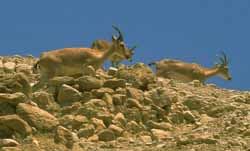
Ein Gedi
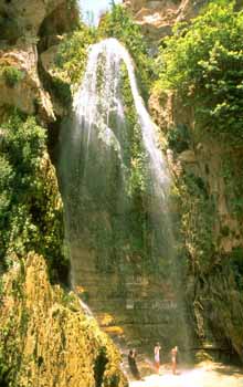 |
The Bible records that 3,000 years ago David hid from King Saul atEin Gedi. When David surprised the King and spared his life after finding him unarmed, Saul said David would succeed him on the throne.
Located on the Dead Sea's western shore, Ein Gedi ("spring of the goat") is a desert oasis with waterfalls, pools of water and two large streams. It is a hiker's paradise with beautiful foliage, exotic birds and a range of wildlife, including rabbits, deer, ibex and leopards (don't worry, you're not likely to run into any).
Ein Gedi served as a water source during biblical times (Joshua 15:62,I Samuel 24:1-2). The spring begins to flow 656 feet above the Dead Sea. About a half-hour's hike will take you to a waterfall and pool. Another trail leads to Shulamit Spring, the top of the falls and the Dodim Cave. Further along are the ruins of a Chalcolithic sanctuary believed to be from the year 4,000 B.C.E. From atop the trail it is possible to get a spectacular view of the Dead Sea, the mountains of Moab and Kibbutz Ein Gedi.
The oasis is known for its thriving date palms, which are the principal crop of nearby Kibbutz Ein Gedi. The Kibbutz also owns a spa further south where you can take a hot mineral bath and coat yourself in Dead Sea mud. A camp site is also situated near the Dead Sea beach.
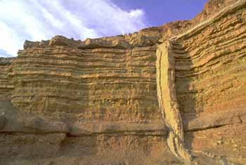 |
Just north of Ein Gedi (about 40 minutes south of Jerusalem) is one of Israel's most important archaeological sites, the QumranNational Park. It is in the caves of this ancient settlement that theDead Sea Scrolls were discovered in 1947. Evidence has been found of people inhabiting the caves as early as the 8th-7th centuries B.C.E. The Romans stormed the area and occupied it for 20 years. In 132-135 C.E., Bar-Kokhba's fighters lived in the ruins. The community, referred to as the "Dead Sea Sect," to which the Dead Sea Scrolls apparently belonged lived in Qumran around 130 B.C.E. to 70 C.E.
Before the king arrives at his couch,
My perfume hovered fragrantly
My love will lie between my breasts.
Like a sack of myrrh,
A cluster of blossoms,
Picked from the vineyards of Ein Gedi.
My perfume hovered fragrantly
My love will lie between my breasts.
Like a sack of myrrh,
A cluster of blossoms,
Picked from the vineyards of Ein Gedi.
--From the Song of Songs
Masada
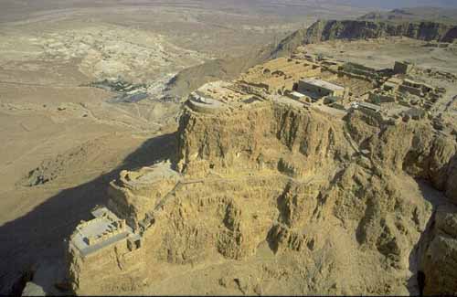 |
Masada (Hebrew "fortress") is a flat plateau measuring roughly 1,000 by 2,000 feet, situated atop an isolated rock cliff at the western end of the Judean Desert. At the eastern end, the rock falls in a sheer drop of nearly 1,500 feet to the Dead Sea (the lowest point on earth, some 1,300 feet -- 400 meters -- below sea level) and, on the western side, it stands about 300 feet above the surrounding terrain.
It is traditional to climb Masada in the early morning, before the desert gets too hot, to watch the sunrise over the Dead Sea from the fortress. You can either hike up the snake path (about a 45-minute walk) or take a short cable car ride to the summit. Either way, you will enjoy one of the world’s most spectacular sights and experience the dawning of a new day like you have never seen before.
History
The only written source about Masada is Josephus Flavius’ book, The Jewish War. He wrote thatHerod the Great built the fortress of Masada between 37 and 31 BCE as a refuge. The water supply came from a network of large, rock-hewn cisterns on the northwestern side of the hill. They filled during the winter with rainwater flowing in streams from the mountain on this side. Cisterns on the summit supplied the immediate needs of the residents of Masada and could be relied upon in time of siege.
On the northern edge of the steep cliff, with a splendid view, stood the elegant, intimate, private palace-villa of the king. It was separated from the fortress by a wall, affording total privacy and security. Along the western casemate wall, Herod built a palace, the largest building on Masada, covering approximately one acre.
At the beginning of the Great Revolt of the Jews against the Romans in 66 CE, 75 years after Herod’s death, a group of Jewish rebels overcame the Roman garrison of Masada. After the fall ofJerusalem, and the destruction of the Second Temple (70 CE), they were joined by zealots and their families who had fled from Jerusalem.
This small band of 960 Jews held out against the mightiest army in the world for three years. TheRomans, however, were not about to let even this handful of rebels, which had played a key role in starting the revolt, get the best of them. In 73 CE, the Roman governor Flavius Silva marched against Masada with the Tenth Legion and 10,000 Jewish slaves.
With the strategic advantage of the high ground, the defenders could easily target their attackers, but the Romans were persistent. They constructed a rampart of thousands of tons of stones and beaten earth against the western approaches of the fortress and, in 74 CE, moved a battering ram up the ramp and breached the wall of the fortress.
Once it became apparent that the Tenth Legion's battering rams and catapults would soon succeed in breaching Masada’s’s walls, Elazar ben Yair, the Zealots’ leader, decided that all the Jewish defenders — men, women and children — should burn the fortress and commit suicide. According to Josephus, two women and five children managed to hide themselves during the mass suicide, and it was from one of these women that he heard an account of Elazar ben Yair's final speech in which he said the Zealot’s "preferred death before slavery."
Israel Fact
During the excavations, Yadin found 25 skeletons of men, women, and children. In 1969, they were buried at Masadawith full military honors.
|
The heroic story of Masada and its dramatic end attracted many explorers to the Judean desert in attempts to locate the remains of the fortress. The site was identified in 1842, but intensive excavations took place only in 1963-65 under the leadership of Yigael Yadin. The Israeli army and thousands of volunteers from 128 countries assisted in the project.
The archaeologists found Herod’s residential and western palaces, a storehouse complex, bathhouse, two mikvaot (ritual baths), artifacts such as coins and pots and a synagogue (the oldest in Israel) used by Masada’sdefenders.
For many years, new members of the Israeli Defense Forces would be sworn in at Masada and promise that Masada would not fall again. The practice was abandoned in 1986, Rabbi Lawrence Hoffman says, because "its underlying message of heroes who commit suicide no longer captured the imagination of a Jewish state which emphasized life, not death, and victory rather than defeat." Nevertheless, Masada remains the symbol of the determination of a people to be free in its own land.
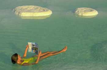 Visitors can float effortlessly on the waters of the Dead Sea due to its concentration of minerals, which is the highest in the world. The air is extremely dry, and temperatures are high throughout the year (max. 86° [30° C]) during winter, and 104° [40° C]) during summer) making the Dead Sea a destination for visitors 365 days a year.
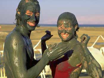 Floating is a novelty that makes visiting the Dead Sea a kick, but most visitors come for the therapeutic value of the mud and salt water. People with skin disorders such as psoriasis and ailments such as arthritis have found relief from treatments using the Sea's natural resources. Oh, and if you have an open cut or sore, be forewarned, the salt water stings.
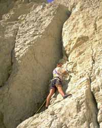
The Dead Sea
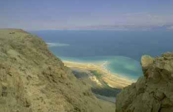 |
The Dead Sea (Yam Hamelakh -- "The Salt Sea") is the lowest place on earth, roughly 1,300 feet (400 meters) below sea level.
It is 34 miles (55 km.) long and varies between 11 miles (18 km.) and 2 miles (3 km.) in width.
The Sea is 1,400 feet (430 m.) deep.
This unique sea is fed by the Jordan River. There is no outflow; and the exceptionally high rate of evaporation (high temperatures, low humidity) produces large quantities of raw chemicals. These are extracted and exported throughout the world for use in medicine, agriculture and industry.
The Dead Sea is actually shrinking. The southern end is now fed by a canal maintained by the Dead Sea Works, a company that converts the Sea's raw materials, particularly phosphates, into commercial products.
Visitors can float effortlessly on the waters of the Dead Sea due to its concentration of minerals, which is the highest in the world. The air is extremely dry, and temperatures are high throughout the year (max. 86° [30° C]) during winter, and 104° [40° C]) during summer) making the Dead Sea a destination for visitors 365 days a year.Floating is a novelty that makes visiting the Dead Sea a kick, but most visitors come for the therapeutic value of the mud and salt water. People with skin disorders such as psoriasis and ailments such as arthritis have found relief from treatments using the Sea's natural resources. Oh, and if you have an open cut or sore, be forewarned, the salt water stings.
Archaeological ruins are scattered in the area. Many historical fugitives, such as David, Jesus, Jewish zealots and Christian monks, found peace and refuge around the Dead Sea. The area is best known, however, for being the site of the biblical towns of Sodom and Gomorrah. South of the Sea, on the way to Eilat, is a rock salt formation that tourists are told is Lot's wife. According to the Torah, Lot's wife ignored G-d's admonition not to look back at the cities he was destroying as they left and was turned into a pillar of salt (Genesis 19:26).
Incidentally, all the fun near the Dead Sea is not confined to the mud and water!
The Negev Desert
What comes to mind when you think of the desert?
Perhaps a scene from Lawrence of Arabia or The Ten Commandments with a solitary person in a white robe and sandals struggling through endless sand and large dunes whipped up by brutal winds under a scorching sun.
The Negev in southern Israel can be oppressively hot, but you won't see the type of sand dunes associated with the Sahara or other deserts. Actually, the Negev is filled more with dirt, rocks and canyons, which are no less forbidding. The Negev is also beautiful, highlighted by remarkable landscapes, waterfalls, caves, archeological sites, cities, craters and a rich history.
Israel Fact
“It is in the Negev that the creativity and pioneer vigor of Israel shall be tested.”- David Ben-Gurion.
|
In 1947 and 1948, when the boundaries of the Jewish and Arab states were being debated by diplomats, David Ben-Gurion insisted the Negev be part of the Jewish state. Though it was virtually uninhabited and thought by many to be uncultivable, Ben-Gurion knew this region was needed if the state was to grow. He also had faith the desert could be tamed and turned into a place where Jews could settle and prosper. More than 50 years later, his vision has been realized.
The Negev encompasses about half the land mass of Israel. It is framed by the borders of Jordan and Egypt, with its southernmost tip at Eilat. Though Israeli leaders from Ben-Gurion on have stressed the importance of settling the area, it remains undeveloped and sparsely populated. For centuries, the area has been "home" to Bedouins who have increasingly given up their nomadic lifestyle and  settled in permanent homes. It is often possible to visit the permanent and semi-permanent tents of these hospitable people and enjoy sweet tea and the best pita you'll ever taste filled with goat cheese and a delicious spice called zater. Some of the encampments are regular stops for tourists, but others are more authentic villages where sheep and goats are tended, and the ways of old still are observed by young and old alike.
settled in permanent homes. It is often possible to visit the permanent and semi-permanent tents of these hospitable people and enjoy sweet tea and the best pita you'll ever taste filled with goat cheese and a delicious spice called zater. Some of the encampments are regular stops for tourists, but others are more authentic villages where sheep and goats are tended, and the ways of old still are observed by young and old alike.The gateway to the Negev is a place that once was little more than a watering hole for Abraham's sheep. Today, Beersheba is a modern city of 130,000. Further south is Kibbutz Sde Boker, where Ben-Gurion made his home. Today, the hut where he lived is a museum devoted to his legacy.
The Central Negev is marked by Makhtesh Ramon, which is usually referred to as a crater, but is actually a valley surrounded by steep walls. Rappeling off the edge of the crater is popular, but not recommended for beginners. For those who don't mind a less direct route, there are trails for hikers into the crater.
Between Beersheba and Makhtesh Ramon is a whole lot of nothing, except beautiful and sometimes forbidding landscapes. Seemingly in the middle of nowhere are the remains of ancientNabatean Cities.
The Eastern Negev has two of the area's larger towns. The first is Arad, a development town that serves as a convenient stopover for visitors to the Dead Sea and Masada. The town is also popular because of its clean, dry air, which makes it a haven for people suffering from asthma and allergies. Nearby is Tel Arad, site of a biblical town that is one of the earliest known urban settlements.Further south, on the way to Eilat is Dimona, a town established in the 1950s to help absorb Jewish inmigrants. Originally considered too remote and its climate too unpleasant for large-scale settlement, the town has grown to be a thriving community of more than 20,000. It is best known, perhaps, as the site of Israel's nuclear research program and is believed to be the site where nuclear weapons have been developed. It is also known as the home of the Black Hebrews, a sect that originally came from Chicago and settled in Dimona.
Just beyond Dimona is Mamshit, one of the best preserved of the Nabatean towns. It was built in the first century, probably the last of the five cities the Nabateans built along the roads from their capital in Petra to the coast. Over the course of several centuries, the Nabateans abandoned their nomadic way of life and became permanent settlers who focused on agriculture. Given the harsh climate, this was a strange choice, but the Nabateans proved to be remarkable engineers and developed sophisticated systems for controlling the scant water resources.
Mamshit was annexed by the Romans in 106 C.E. and the town was renamed it Memphis. The town grew for several centuries until being abandoned after theMuslim conquest in 636. During the Byzantine era, three churches were constructed and the remains of some of the mosaics are still visible as are parts of the Roman city walls. In one room archaeologists found a bronze jar filled with 10,000 silver coins dating from the first and second centuries.
The southern route to Eilat, a long and mostly boring stretch of more than 100 miles, is dotted with small agricultural settlements, including two kibbutzim affiliated with Reform Judaism. TheYotvata kibbutz, just north of Eilat, is one of the major dairies in Israel, which is open to visitors.
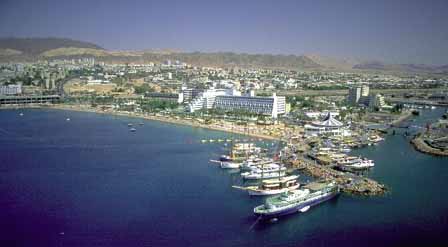 The sun always shines in Eilat (it rains about a half dozen days a year) and the average daytime temperatures rarely dip below 70°F (21°C), even in winter. During the summer, temperatures can soar well above 100°F and the water can feel almost like a Jacuzzi. Even in mid-winter, the average daytime water temperature stays above 68°F (20°C). Make sure to drink lots of water, keep your head covered and wear sun screen (your mother asked me to put this in).
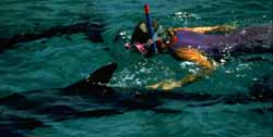 Even if you're not a diver, you can enjoy the magnificent coral reef from the surface with a snorkel and mask or on a glass-bottom boat ride (though you usually don't see nearly as much). If you want a really unique view (and don't mind spending the money), try an underwater safari in a submarine (yup, it's a real one) that holds 50 people and takes you 200 feet below the surface. And, if you're really a landlubber, there's the Coral World Underwater Observatory that lets you enjoy the wonders of the Sea as if it were an aquarium. One of only four in the world, the observatory offers a kaleidoscopic view of the reef and sea life 15 feet below the surface. One of the newer Eilat attractions is Dolphin Reef, where you can swim and dive with dolphins.
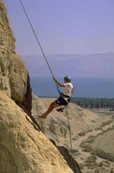 And there's plenty of activities outside the water, including rappelling on craggy cliffs of the desert mountains, hiking in the desert and mountain biking.
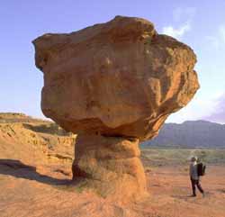 About 17 miles (27 km.) north of Eilat is the Timna Valley National Park. This desert area is another good place for hiking, jeep tours and camel rides. It is the site of ancient copper mines said to be run by King Solomon. The most striking site is "The Mushroom." Once you see it, you'll immediately understand how this sandstone rock formation got its name. Another impressive formation is Solomon's Pillars. Timna also has an artificial lake and has become a popular recreational area for Israelis.
History
A resort town of 20,000 and bustling port, combining sea and desert, Eilat lies at Israel's southernmost tip.
The sun always shines in Eilat (it rains about a half dozen days a year) and the average daytime temperatures rarely dip below 70°F (21°C), even in winter. During the summer, temperatures can soar well above 100°F and the water can feel almost like a Jacuzzi. Even in mid-winter, the average daytime water temperature stays above 68°F (20°C). Make sure to drink lots of water, keep your head covered and wear sun screen (your mother asked me to put this in).
Unless you're going by plane from Tel Aviv (an hour flight), it's a very long schlep (about a four hour drive from Tel Aviv or Jerusalem), but one you'll be glad you took, especially if you're into water sports.
Eilat is a great place for water skiing and swimming. The calm surface of the sea is also ideal for boating activities: sailboats, rowboats, kayaks and motor boats.
The main attraction of Eilat is diving in the Red Sea (actually an inlet from the sea known as the Gulf of Eilat or Aqaba), one of the world's most spectacular underwater preserves. You can see brightly colored coral and fish and may see everything from a venomous lionfish to a moray eel to a shark to a sea turtle to a manta ray.
Even if you're not a diver, you can enjoy the magnificent coral reef from the surface with a snorkel and mask or on a glass-bottom boat ride (though you usually don't see nearly as much). If you want a really unique view (and don't mind spending the money), try an underwater safari in a submarine (yup, it's a real one) that holds 50 people and takes you 200 feet below the surface. And, if you're really a landlubber, there's the Coral World Underwater Observatory that lets you enjoy the wonders of the Sea as if it were an aquarium. One of only four in the world, the observatory offers a kaleidoscopic view of the reef and sea life 15 feet below the surface. One of the newer Eilat attractions is Dolphin Reef, where you can swim and dive with dolphins.And there's plenty of activities outside the water, including rappelling on craggy cliffs of the desert mountains, hiking in the desert and mountain biking.
Less well-known is the fact that Eilat is one of the best places in the world forbird watching. Approximately one billion birds traverse the area between the Mediterranean coast and the Jordan mountains, making southern Israel the site of one of the greatest concentrations of migrating birds in the world. The migration from Europe to Africa takes place from September to November and the return flight begins in March and lasts through May. Eilat is the headquarters for the International Birdwatching Center.
If the searing heat hasn't sapped all your energy, Eilat is also known as a great place to party at night with lots of restaurants, bars and nightclubs. It's also a good place to shop because the city is a free trade zone with no VAT.
Into the Desert
About 17 miles (27 km.) north of Eilat is the Timna Valley National Park. This desert area is another good place for hiking, jeep tours and camel rides. It is the site of ancient copper mines said to be run by King Solomon. The most striking site is "The Mushroom." Once you see it, you'll immediately understand how this sandstone rock formation got its name. Another impressive formation is Solomon's Pillars. Timna also has an artificial lake and has become a popular recreational area for Israelis.
Also in the area is the Hai Bar wildlife reserve. This 8,000-acre sanctuary is home to many rare and endangered desert animals. You can take a tour through the reserve, though it's unlikely you'll see too many of the animals during the hot part of the day unless you go to a special dark room where some of them can be viewed. Rest assured, however, leopards, cheetahs, hyenas, gazelles, ostriches and many other species live in the park.
When Israel signed its peace treaty with Egypt, the desert where Moses led the Israelites for 40 years and received the Torah became Egyptian territory. Today, Sinai is largely off the main Israeli tourist route, though seaside resorts along the Gulf of Aqaba are booming. It is still possible to travel through the desert and make the strenuous hike up to the Byzantine monastery of Santa Katerina on Mt. Sinai. The Egyptian consulate in Eilat offers a "Sinai Only" pass to tour the immediate region. To go further south, beyond Sharm-el-Sheik, or to cross the Suez Canal into the main part of Egypt, you need an Egyptian visa.
History
The derivation of Eilat's name is unclear. It may come from the Hebrew word,ayil, which means "ram." These animals grazed here in the time of Abraham. In the Bible, the Israelites "passed by the way of the plain of Elath" and "encamped at Etzion Gaber" (Numbers 33:35 and Deut. 2:8-9). King David is believed to have established his southernmost defense line here. The area was developed by his son, Solomon, who built a navy that he used to bring back gold and spices from the land of Ophir (1 Kings, 9:26). The Queen of Sheba was also supposed to have passed through Eilat on the way to see the King in Jerusalem.
King Jehoshophat of Judah also built a navy in Eilat, but it was lost in a storm. During the reign of King Ahaz, Eilat fell to the King of Syria. From that point on, the city changed hands -- and names -- many times. The Egyptians called it Berenice and the Romans Aila. Eilat's importance gradually declined, particularly after the Ottoman Turks built a new port at nearby Aqaba. Up until 1949, Eilat was little more than a small Turkish police station called Um-Rashrash. The ancient site of Eilat with remains from the Nabatean, Roman, Byzantine, and medieval periods has been located north of present day Aqaba.
On March 13, 1949, Israeli forces occupied Eilat in the "Operation Uvdah" ("Established Fact"), in the last military move in the War of Independence. According to the United Nations partition plan, Eilat was to be the southernmost tip of the Jewish state. In December 1949, members of the Kibbutz ha-Me'uhad set up a temporary camp in Eilat. Since Israeli independence and the opening of the Straits of Tiran in the 1956 Sinai War, the town has gradually grown into the major resort it is today.
The Cause of War
The Red Sea area is beautiful, but it is also important to the political history of Israel. Your first thought might be of the biblical story of Moses parting the Red Sea when the Israelites left Pharaoh's Egypt, but both biblical scholars and archaeologists believe the biblical reference is to the Sea of Reeds, which no longer exists and was in a different location. Eilat was, however, an important port dating to the reign of King Solomon.
 |
The Red Sea played a role in more recent Jewish history. If you look at the map, you'll notice Israel is not the only riparian nation. On the northeast end of the Gulf, Jordan borders the Sea. Its port of Aqaba is just three miles (5 km.) east of Eilat. Most of the eastern shore is Saudi Arabia; yes, Saudi Arabia (bet you didn't realize it was so close to Israel -- 12 miles south of Aqaba). And, the territory at the southern tip, and across the sea guarding its entrance is Egypt.
Shortly after Israel's victory in its War of Independence in 1948, and again in 1967, Egypt blockaded the Strait of Tiran leading from the Red Sea into the Gulf of Eilat (which stretches 140 miles from Eilat to Sharm-el-Sheikh), preventing Israeli shipping from moving in or out of the port of Eilat and thereby cutting Israel's lifeline to Africa and the Far East. The Israelis considered this an act of war and was one of the reasons for attacking Egyptin what became the Sinai Campaign of 1956 and the Six-Day War of 1967.
In the first war, Israel captured all of the Sinai desert and controlled the entire peninsula adjacent to the Gulf. Underpressure from President Eisenhower, Israel withdrew and a UN peacekeeping force was deployed to insure Israel's freedom of shipping.
In 1967, the force was withdrawn at the request of Egyptian President Nasser (in violation of the UN agreement creating the force) and he again blockaded the strait. In the brief war that followed, Israel reconquered the area. This time, it held the area along the Sea until signing a peace treatywith Egypt in 1979. Israel withdrew from the area south of Eilat in 1982, though it tried to hold the small town of Taba near the southern tip of the Gulf where it had built a tourist resort. After international mediation, however, Israel agreed to return Taba to Egypt in 1988.
Israel's relations with Jordan have been less rancorous and, since the signing of the Israeli-Jordanian peace treaty in 1994, a number of cooperative projects have been developed for the Eilat/Aqaba region, including one to protect the Gulf. Just north of Eilat it is possible to book a trip to Jordan to visit Petra. A tourist visa is required to enter Jordan.
The largest riparian state, Saudi Arabia, remains technically at war with Israel. Though it has never played a major role in the Arab-Israeli conflict, beyond financing Arab forces, Israel has remained concerned about the Saudis' massive arms buildup. Indeed, when you travel south of Eilat and can look across the Gulf and see Saudi Arabia, it is easier to understand why Israel's friends have been concerned over the years about the sale of sophisticated U.S. aircraft to the kingdom.
 When Ben-Gurion spoke of the future of the Negev, he was not doing so for mere rhetorical flourish. He believed what he said and made his home there, joining Kibbutz Sde Boker in 1953. Today, the hut where he lived is a small museum devoted to Ben-Gurion's legacy.
Beersheva
In 1947 and 1948, when the boundaries of the Jewish and Arab states were being debated by diplomats, David Ben-Gurion made it clear the Negev must be part of the Jewish state.
Though it was virtually uninhabited and thought by many to be uncultivable, Ben-Gurion knew this region was needed if the state was to grow. He also had faith that the desert could be tamed and turned into a place where Jews could settle and prosper.
Many decades later, his vision has been realized. Still, the desert remains untamed.
This is the wilderness where man met God. Here Abraham communed with God, and, centuries later, the prophet Elijah came to the Mountain of God for a momentous encounter with the Creator.
This, in fact, is the region that gave birth to civilization on the banks of the great rivers that surround the desert, and in the oases on the fringes of the wilderness. The desert trails of the Negev were the conduits for knowledge, culture and development.
Beersheba was first settled during the Chalcolithic period. The inhabitants lived in caves and worked in raising cattle and the manufacturing of metal tools. At the beginning of 2000 BCE,Abraham and Isaac arrived in Beersheba. There they dug wells and also formed alliances with Abimelech, the King of the Philistines. During King David's reign, the Israelites conquered Beersheba, which became a city of the tribe of Simeon and was later incorporated into the tribe of Judah (Josh. 15:28; 19:2). The city became the capital of the “Negev Yehuda." Following the Israelites defeat from the conquering Babylonians, the city was deserted for many years. However, after the Jews return from Babylon it was resettled (Neh. 11:27, 30). During the Roman-Byzantineperiod, after 70 CE, Beersheba became apart of the frontier -line defenses against attacks by the Nabateans. The town was abandoned in the Arab period.
The city was redeveloped by the Turks in 1900. Jewish settlement also began to return to the city during this time. On October 31, 1917, Beersheba was the first place in Israel captured by the British in World War I. During the British mandatory period, the city continued to develop and grow in size. During the 1936-39 Arab riots, most of the Jews left the city, but strong efforts were made in the 1940s to purchase land for Jewish settlement in the Negev. Following the declaration of independence of the State of Israel, the invading Egyptian army made Beersheba its headquarters. On October 21, 1948, the Israeli forces took the city in "Operation Moshe"; upon the Israeli conquest, the city was totally abandoned by its citizens. Following the war, Jewish settlers, mostly new immigrants, began to establish themselves there.
The Negev is still virtually unknown to most travelers. Its hidden canyons, vast expanses, clear blue skies, and stark promontories are still off the beaten track and provide a worthy challenge to those seeking adventure and thrills.
When Ben-Gurion spoke of the future of the Negev, he was not doing so for mere rhetorical flourish. He believed what he said and made his home there, joining Kibbutz Sde Boker in 1953. Today, the hut where he lived is a small museum devoted to Ben-Gurion's legacy.
The gateway to the Negev is a place that once was little more than a watering hole for Abraham'ssheep. Today, Beersheba is a modern city of 130,000 and home to the Ben-Gurion University. It is also a place where you can still buy sheep and camels at the Bedouin market (open Thursdays 6 a.m.-1 p.m.). Roughly 27,000 Bedouin still live their nomadic lifestyle in the Negev.
 |
The name Beersheba comes from "The Well of the Oath" that Abraham made to Abimelech (Gen. 21:27 and 31). A stone-enclosed well said to be the one used by Abraham is at the corner of Derekh Hebron and Rehov Keren. Isaac and Jacob also lived in this area, which later was given to the Tribe of Simeon.
Though the city has remnants from the Roman and Byzantine periods, it was really little more than a collection of wells where Bedouin watered their flocks until the early 20th century when the Turks built a small town. The city was held by the Egyptians at the time of Israel's War of Independence, and was conquered in "Operation Ten Plagues" on October 21, 1948.
Just outside Beersheba is Hatzerim, the first air base built by Israel. Today, it serves the Israeli Air Force and hosts the pilot school. Next door is the Air Force Museum, one of the coolest museums for anyone interested in airplanes, helicopters and Israeli history. In addition to a gallery with displays of missiles and rockets and information on Israel's elite rescue squad and survival tactics, there is hall showing films and a huge outdoor exhibition area with examples of aircraft from the Israeli Air Force as well as some of its enemies. Some of the highlights include U.S.-made phantom jets, Soviet MiGs, the Israeli Lavie and the “Bar Mitzvah Twins,” two aircraft whose pilots each shot down 13 enemy aircraft in combat. While visiting you’ll likely hear the roar of engines from the base next door and may even catch a glimpse in the sky of one of the Air Force’s state-of-the-art fighter planes. Oh, and the museum is also known for having some of the most beautiful tour guides, all women performing their compulsory military service in the Air Force.
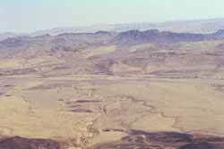 There are two campgrounds available on the east side of the main road. There are also numerous pathways for both the casual and serious hikers.
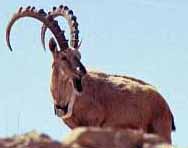 A variety of plants grow in the Ramon area, including Atlantic pistachio trees, buckthorn, globe daisy, tulips and other bushes and shrubs. Many animals also can be found here including the ibex, leopard, striped hyena, sand fox, Dorcas gazelle and the ever popular fat desert rat.
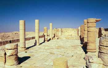 About 14 miles north of Mitzpe Ramon is the Nabatean outpost of Avdat, which was named after their king Obodas (Abdat) II. The ruins of the city and its structures sit atop a hill overlooking the road and an experimental farm set up in 1959 to conduct research on ancient desert agriculture. Most of the surviving structures are not Nabatean, but Roman and Byzantine. The best preserved area is a Byzantine church whose columns and apse are still relatively intact. One suggestion you don’t find in a typical guide book is to lick the wall of the "salt cave" to confirm that it was indeed the place where salt was stored.
Makhtesh Ramon
Much of the Negev Desert is vast, brown, dry and uninteresting.
It is also beautiful, fascinating and rich in geological history.
This region makes up nearly half the State of Israel, but the population of the desert communities is less than 20% of the total. After withdrawing from the Sinai as part of the peace treaty with Egypt, the Negev also became the site of numerous military bases.
Located south of Beersheba in the Central Negev, Makhtesh Ramon is usually referred to as a crater, but it is not an impact crater from a meteorite, it is actually a "makhtesh," a valley surrounded by steep walls and drained by a single "wadi" (riverbed). It is the world’s largest makhtesh.
Makhtesh Ramon is at the center of two large nature reserves, Har Hanegev and Matzok Hatzinim. Makhtesh Ramon is 25 miles (40 km.) long and 5 miles (9 km.) across at its widest point. Mount Ramon, at the southwest corner of the makhtesh, is the highest peak in the Negev (3,400 feet – 1,037 m.). The name Ramon comes from the Arabic "Ruman" meaning Romans.
Makhtesh Ramon is a geologists’ paradise with fossils, rock formations and volcanic and magmatic phenomenon dating back as much as 220 million years. The Ramon crater began forming when the ocean that covered the desert began to move north. Water and other climatic forces slowly began to flatten the curve on top. Much later, the Arava rift valley was formed and the rivers began to change their flow. As this occurred, it carved out the crater. The crater is about 1,650 feet (500 m.) deep. Some rocks at the bottom of the crater can be dated back 220 million years. A black hill in the north, Giv'at Ga'ash, was once an active volcano. Also, vertical dikes of magnum which squeezed upward through fissures can be seen at various spots through the makhtesh. The lowest spot in the crater, Ein Saharonim, contains its only natural water source. From the visitor’s center, it is possible to get a spectacular panoramic view of the crater.
There are two campgrounds available on the east side of the main road. There are also numerous pathways for both the casual and serious hikers.A variety of plants grow in the Ramon area, including Atlantic pistachio trees, buckthorn, globe daisy, tulips and other bushes and shrubs. Many animals also can be found here including the ibex, leopard, striped hyena, sand fox, Dorcas gazelle and the ever popular fat desert rat.
Rappeling off the edge of the crater is popular, but not recommended for beginners. For those who don’t mind a less direct route, there are trails for hikers into the crater. Nearby is one of those bizarre, "what’s it doing in Israel?" kind of attractions — the Mitzpe Ramon Alpaca Farm, which has both alpacas and llamas for the production of wool.
Israel Fact
One animal that had disappeared from Israel was the onager. In 1983, 14 were reintroduced. The onager is the smallest wild horse and cannot be domesticated. In Roman times, their meat was considered a delicacy.
|
Because of the clear, unpolluted air, the altitude and the absence of lights in the area, Mitzpe Ramon is a great place for star gazing at night. Serious astronomers use the observatory on Mount Ramon.
The Nabatean Cities
The tribe of Simon settled in the Negev and King David firmly established Israelite rule over the desert. Solomon subsequently built a string of fortresses along the roads. The fall of the kingdom of Judea was followed by the rise of the Nabateans beginning in the fourth century B.C.E. These traders traveled in caravans from Arabia and made their capital Petra, in what is now southern Jordan. They eventually controlled trade in perfumes and spices and built numerous fortresses along the branch of the Spice Route cutting across the Makhtesh Ramon area.
Part of their success in the harsh desert environment was due to their ingenuity in conserving water. The Nabateans built dams, terraces, cisterns and reservoirs that were very efficient in collecting rain water and irrigating crops. Elements of this water system survive in the ruins of many of the Nabatean cities.
About 14 miles north of Mitzpe Ramon is the Nabatean outpost of Avdat, which was named after their king Obodas (Abdat) II. The ruins of the city and its structures sit atop a hill overlooking the road and an experimental farm set up in 1959 to conduct research on ancient desert agriculture. Most of the surviving structures are not Nabatean, but Roman and Byzantine. The best preserved area is a Byzantine church whose columns and apse are still relatively intact. One suggestion you don’t find in a typical guide book is to lick the wall of the "salt cave" to confirm that it was indeed the place where salt was stored.
Another nearby Nabatean settlement is Shivta, whose ruins date back to the first or second century B.C.E. This city was along the trade root between Gaza, Eilat, the Far East and Arabia. Shivta was a supply center for the northern Negev when the Nabateans were in power and a key outpost to protect pilgrims traveling to Mt. Sinai during the Byzantine period.
Sde Boker is about another six miles south. In between, literally in the middle of nowhere, is the canyon of Ein Avdat. From the rim, you can look down to the riverbed and see the beautiful caparis flowers clinging to the cliffs. It is also possible to hike in the canyon to pools and a waterfall. A number of caves, apparently used by monks, have also been found in the canyon.
Nabatean control of the Negev gradually weakened after the death of King Aretas IV (9 B.C.E.-40 B.C.E.). Fewer camel caravans passed through the area after its takeover by the Romans, and the Spice Route was supplanted by other roads.
Unlike most areas in the country, the Romans did not do a lot to develop the Negev. This changed during the Byzantine period, however, as Christians began to build churches and study centers. Settlement of the Negev came to an end after the Muslim conquest in the seventh century. The new rulers had little interest in the area and the residents were expelled.
For centuries, the only people in the Negev were nomads. When the British mandate period began, the region enjoyed rapid growth. The British paved the highway from Beersheva to Eilat, the road from Beersheva to the large Makhtesh and the "Petroleum Road" from Yeruham to Avdat and Makhtesh Ramon. In March 1949, during Israel’s War of Independence, the Israeli army vanquished the Egyptians in the desert campaign and captured the Negev for the State of Israel.
The Israel National Trail
Ever wanted to literally walk through history?
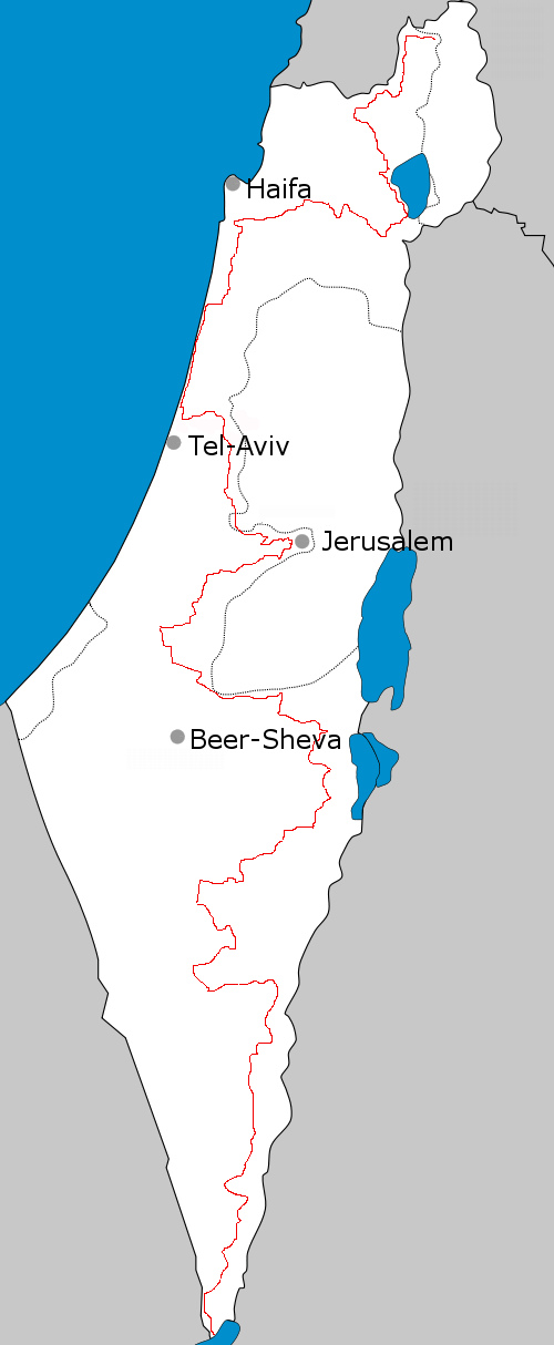 Trail Route - CLICK FOR LARGER VIEW |
The Israel National Trail (INT), running approximately 620 miles (1000 kilometers) from the Gulf of Eilat in the south to Har Dan in the north, gives you this opportunity. And more.
Because of the way the INT traverses Israel's unique physical, ethnic, and religious landscape, it has gained a reputation as one of the world's great long-distance treks. In fact, in 2012, the National Geographic magazine named the INT as one of the "World's Best Hike" for its ability to " delve into the grand scale of biblical landscapes as well as the everyday lives of modern Israelis."
Starting at Har Dan on the Israel-Lebanon border at the northern end of the Galilee, the Trail includes 11 sections the wind their way through Israel to the Red Sea and the coastal oasis town of Eilat at the southern tip of the Negev Desert.
From Har Dan, hikers pass the Naftali Ridge and Ramim Cliffs overlooking the Hula Valley, where some of the very first settlers to Israel began establishing villages. Next comes the Yesha Fortress, the Kadesh Stream, Mount Meron near the ancient city of Tzefat, and then to the Shema ruins. At this point hikers find themselves in the foothills of the Lower Galilee and will pass Mount Tabor and the Tzippori Stream before heading to the Carmel Region and the Nachash Stream.
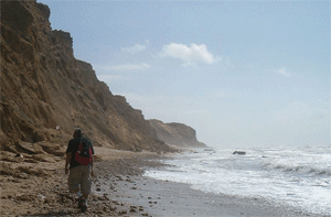 |
After this part, the Israel National Trail continues through the Sharon plain, Gush Dan, and Shephelah areas during which hikers can take a relaxing break by veering off to any of a number of coastal cities such as Tel Aviv and Jaffa.
From here, the Shayarot Range in the Judean Mountains in next, a hike which offers spectacular views down to the Coastal Plain and up into the higher Judean Mountains of the West Bank and Jordan. Hundreds of kilometers of mountain dirt tracks, walking routes, caves, and an abundance of flowers in the spring dot this part of the trial. This part of the trail also passes through the"Burma Road", where hikers can climb to the military posts overlooking Highway 1, the Jerusalem-Tel Aviv road, used by Palmach soldiers in their battles to free Jerusalem during the Israeli War of Independence. At this point the route has a two day site-trip to Jerusalem via the Jerusalem Trail.
Hikers continue past Israel's capital via that Yatir ruins and Dragot quarry and then into the vast expanse of the Negev Desert where the trail winds through the Mamshit stream, Machtesh Ramon, Ovda Valley, and then finally past the Shchoret Stream and into Eilat and the Red Sea.
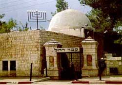 According to the Bible, Jacob's wife, Rachel, who had long been unable to conceive, died while giving birth to Benjamin (Genesis 35:19). She is the only Matriarch not buried in Hebron. Rachel's Tomb is inside a domed building built in 1841 by Sir Moses Montefiore. The tomb originally consisted of 11 stones laid flat, with one stone above the others. Legend holds that Jacob's 11 sons placed the first stones and their father added the last one. Jewish women, in particular, make pilgrimages to the site to pray for children. Muslims also consider the place holy and built a cemetery nearby.
Bethlehem
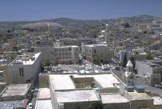 |
Like many cities in Israel and Palestine, Bethlehem is biblically important to Judaism, Christianity and Islam.
For Jews, Bethlehem (Bet Lechem) is the burial place of the matriarch Rachel and the birthplace of King David. Additionally, Samuel anointed David as king of Israel in Bethlehem (I Sam. 16:1-13) and David's ancestors - Ruth and Boaz - were married in Bethlehem.
For Christians, Bethlehem is recognized in the gospels of Matthew and Luke as the birthplace of Jesus and is one of the religions holies sites around the world. The town is inhabited by one of the oldest Christian communities in the world, though many Christians have fled the city out of fear of persecution by the Palestinian Arabs.
Bethlehem was first settled by Canaanite tribes who name the city Beit Lahama. They built a temple to the god Lahama on the present mount of the Nativity. Around 1200 BCE, the Philistines had a garrison stationed in Bethlehem because of its strategic location. Following the Israelites rule, the Greeks occupied the region unitl the arrival of the Romans in 160 BCE.
The city, located just 5 miles south of Jerusalem, was turned over to the Palestinian Authority as a result of the 1995 Israeli-Palestinian Interim Agreement. Bethlehem has a population of roughly 30,000 people, a number which has been in steep decline over the past decade as the majority of Christians in the city have emigrated out of the Palestinian territory.
In Hebrew, the town is Bet Lehem ("House of Bread") and in Arabic it is called Bet Lahm ("House of Meat").
For hundreds of years, Christian pilgrims have made the roughly 2½ hour walk from Jerusalem to Manger Square. Today, the trip typically begins at the train station in Abu Tor and proceeds along the Hebron Road.
Manger Square is the focus of activity of Christmas celebrations not once, but three times a year. In addition to the traditional Western celebration which begins on December 24, the Greek Orthodox mark their Christmas on January 6 and the Armenian observance is on January 19.
The Church of the Nativity
The Church of the Nativity was built in the 4th century by the mother of the Byzantine Emperor Constantine. Helena also was the person responsible for the construction of the Church of the Holy Sepulcher in Jerusalem. The present building, the oldest church in Israel/Palestine was reconstructed in the 6th century by the Emperor Justinian (527-565) and further repaired by theCrusaders. In 1250, the Ayyubid Dynasty was replaced by the Circassian Mamlukes, ruled by the fanatical Sultan Beibars. In 1263, Beibars ordered the destruction of the fortifying walls and towers of Bethlehem, but the church was spared. During the Turkish occupation in 1517, the Franciscans and the Greeks fought over control of the Sancutaries.
Following the War of Independence in 1948, Bethlehem fell under the control of the Jordanians. Then after the 1967 Six Day War, the Israelis took control over Bethlehem.
Today, there are many churches present in Bethlehem. The Greek Orthodox have 15 churches and institutions; the Roman Catholics have 25; there are 8 Protestant churches; the Syriac Orthodox have one church and the Greek Orthodox have two churches; and the Ethiopians and the Copts each have one. There are also several Mosques, including the Mosque of 'Umar, across the street from the Church of the Nativity. This mosque was erected in 1849.
The church has a colorful history. When the Persians invaded in 614, they left the church intact, legend has it, because they were moved by a painting inside of the Nativity story depicting the Wise Men of the East in Persian clothes. King Edward IV of England donated wood from English oak trees for the ceiling. He also contributed lead to cover the roof, but that was taken by the Turks, who melted it down to use as ammunition in their war against the Venetians.
The entrance to the church is a low doorway that has its own legends. One story is that the door was installed by the Muslims during their rule to remind Christians that they were guests in the country and must bow to their hosts. An alternative explanation is that the height of the door was designed to prevent unbelievers from entering the church on horseback. Yet another version holds that it was to protect the Christians from their hostile neighbors.
The church is divided into five naves by four rows of Corinthian pillars with pictures of the apostles on them. The names are written in Greek and Latin and many visitors have carved their own signatures over the centuries. The floor of the nave has a hole that allows you to see what remains of the Byzantine mosaics that covered the original church floor.
The Altar of the Nativity sits below a silver and gold chandelier. Stairways on either side of the main altar lead to a grotto. A fourteen-point silver star embedded in white marble indicates the birthplace of Christ. An inscription reads, Hic de Virgine Maria Jesus Christus natus est ("Here Jesus Christ was born to the Virgin Mary"). Fifteen lamps burn around the spot. Nearby is the Chapel of the Manger, where Mary placed the baby Jesus. Like the Church of the Holy Sepulcher, various Christian denominations share control over different parts of the church. The grotto is under the jurisdiction of the Greek Orthodox Church.
The traditional midnight mass celebrated on Christmas Eve is held in St. Catherine's, the Roman Catholic church next door to the Church of the Nativity. This is also the site of several chapels with their own historic and religious significance. The Chapel of St. Jerome is where the Bishop of Bethlehem translated the Old Testament into Latin. The Chapel of the Innocents is devoted to the deaths of the babies killed by Herod. The Chapel of St. Joseph is where an angel appeared to Joseph and commanded him to flee to Egypt.
Not far from Manger Square is the Milk Grotto. According to Christian tradition, this is where Mary spilled some milk while nursing Jesus when she was hiding from Herod's soldiers. The milk turned the rocks of the cave a chalk white color. The rock is believed by some to have healing power and to make nursing easier for women.
Other pilgrimage sites include the Shepherds' Fields, where an angel appeared to the shepherds to announce the birth of Jesus (Luke 2:8-20), the Field of Ruth, where Ruth, the Moabite, gleaned barley from the field for her future husband, Boaz, and David's Wells, three cisterns from which King David longed to drink when the Philistines controlled Bethlehem (2 Samuel 23:13-17).
Not far from the churches is a mosque. During the Pope's visit in March 2000, his mass was briefly interrupted by the call to prayer of the Muslim muezzin.
According to the Bible, Jacob's wife, Rachel, who had long been unable to conceive, died while giving birth to Benjamin (Genesis 35:19). She is the only Matriarch not buried in Hebron. Rachel's Tomb is inside a domed building built in 1841 by Sir Moses Montefiore. The tomb originally consisted of 11 stones laid flat, with one stone above the others. Legend holds that Jacob's 11 sons placed the first stones and their father added the last one. Jewish women, in particular, make pilgrimages to the site to pray for children. Muslims also consider the place holy and built a cemetery nearby.
The Palestinian Authority pins much of its hopes for attracting tourism to Christian pilgrimages to the birthplace of Jesus. Consequently, million of dollars have been poured into this town to develop roads, shops, hotels and the other necessities for accommodating visitors. Though Rachel's Tomb is also in Bethlehem, and is a site of Jewish veneration, it was never a very popular attraction for Jewish tourists. Now that the city is completely under Palestinian control, it is even less so.
Nearby Sights
Just south of Bethlehem is another of Herod's palaces. This one, known as Herodian, was built on the flat top of a cone-shaped hill, nearly 2,500 feet (758 meters) above sea level. Herod's architects actually shaped the mountain to make it symmetrical. The fortress was built in the first century, and like Masada, became a stronghold of the Zealots in the Great Revolt against the Romans. It was also used by the Jews during the Bar Kokhba revolt.
 |
The palace has 70 foot high walls and towers that rise 100 feet above the floor of the fortress. A synagogue, mikve and storerooms have been excavated on the site. The path to the fortress was originally marked by 200 marble steps. From atop the hill, the palace has a commanding view of the Judean Desert,Dead Sea, Bethlehem and the Jerusalem suburbs. According to the historianJosephus Flavius, Herod was buried here, but his final resting place has not been found.
The Mar Saba Monastery was founded by St. Saba of Capadocia in the 5th century. This is a stereotypical monastery where reclusive monks spent years in caves without communicating with anyone. Over the centuries, invaders razed the monastery, but it was rebuilt by the Russian government in 1840. The bones of St. Saba, which had been taken to Venice by the Crusaders, were returned after Pope Paul VI's visit to Israel in 1964 as a goodwill gesture toward the Greek Orthodox Church. The skulls of monks killed through the years are kept in a chapel in the monastery. Even today, women are not allowed inside the monastery.
Two other monasteries are in the Bethlehem area. One is Mar Elias, which was built in the 6th century. According to legend, this is where Elias rested on his flight from the vengeance of Jezebel. The St. Theodosius Monastery was built in 500 C.E. Christians believe the wise men rested here after God warned them in a dream they should not return to Herod.
Also south of Bethlehem, on the way to Hebron, are three giant cisterns known as Solomon's Pools. In truth, they are part of a water system built 2,000 years ago during Roman times and used to supply water to Herodian and Jerusalem.
Gush Etzion
In 1935, Shmuel Holtzman, a citrus grower, started a settlement he called Kfar Etzion. The Arabs destroyed the settlement and crops in 1937 and it was abandoned. In 1943, Jews returned to the area and again planted crops and introduced light industry. By 1948, a group of Jewish settlements had been established that became collectively known as the Etzion Bloc. During Israel's War of Independence, Arab invaders attacked and killed most of the residents. When one group of 14 Jews were surrounded by Arabs when they attempted to return to Kfar Etzion from Jerusalem, they blew themselves up. Another 35 were killed when they tried to lift the siege on the area.
The area, just north of Hebron, was part of Jordan from 1949-1967 and used by the Jordanian army. Following the 1967 war, Jews (many survivors from 1948) returned to resume farming in the area. Local kibbutzim and moshavim have produced turkeys, flowers and candles. Kibbutz Kfar Etzion has a museum recounting the history of the Jews in the settlements.
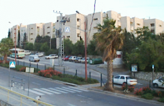 At the time of Abraham, the Canaanite town in this place was known as Kiryat Arba. The name was later changed to Hebron (Joshua 14:15). Today, Kiryat Arba is the name of a suburb of Hebron, five minutes from the Cave of Machpelah and the heart of the city. Established in 1971, Kiryat Arba was the first renewed Jewish community in Judea and Samaria. Today, Kiryat Arba is home to more than 6,000 Jews who have a reputation for being among the most zealous defenders of the idea that Jews have a right to live in the West Bank. The town has educational institutions from pre-nursery school through post-High school, modern medical facilities, shopping centers, a bank and post office.
Hebron
 |
Like Jerusalem, 23 miles to its north, the ancient city ofHebron stirs deep religious and political passions, and has been the scene of heightened tension between Jews and Arabs for much of the last century.
Hebron is revered as one of the four holiest places inJudaism (along with Jerusalem, Safed and Tiberias) and Jews had lived continouslythere for centuries until the small community was forced out after brutal massacres led by Arab residents in the early 20th century. After Israel recaptured the West Bank during the Six Day War in 1967, a number of Jewish families reestablished the community near the ancient Tomb of the Patriachs.
As part of various peace agreements with the Palestinians, the Israeli government has withdrawn its presence from the majority of the city and now allows it to be administered by the Palestinian Authority.
Though the site of conflict during the Palestinian War from 2000 to 2005, the Jewish area of Hebron is now relatively safe and tourists are free to visit the community and the Jewish biblical sites under the guarding eye of the Israel Defense Forces.
History
The Hebrew word "Hebron" is derived from the Hebrew word for "friend" (haver), a description for the Patriarch Abraham, who was considered to be the friend of God. The Arabic "Al- Khalil" — literally "the friend" — has a nearly identical derivation, and also refers to the PatriarchAbraham (Ibrahim), whom Muslims similarly describe as the friend of God.
Hebron, which rises 3,050 feet (926 meters) above sea level, has a long and rich Jewish history. It was one of the first places where the Patriarch Abraham resided after his arrival in Canaan. King David was anointed in Hebron, where he reigned for seven years. One thousand years later, during the first Jewish revolt against the Romans, the city was the scene of extensive fighting. Jews lived in Hebron almost continuously throughout the Byzantine, Arab, Mameluke and Ottoman periods. It was only in 1929 — as a result of a murderous Arab pogrom in which 67 Jews were murdered and the remainder were forced to flee — that the city became temporarily "free" of Jews.
Following the creation of the State of Israel in 1948, and the invasion by Arab armies, Hebron was captured and occupied by the Jordanian Arab Legion. During the Jordanian occupation, which lasted until 1967, Jews were not permitted to live in the city, nor -- despite the Armistice Agreement -- to visit or pray at the Jewish holy sites in the city. Additionally, the Jordanian authorities and local residents undertook a systematic campaign to eliminate any evidence of the Jewish presence in the city. They razed the Jewish Quarter, desecrated the Jewish cemetery and built an animal pen on the ruins of the Avraham Avinu synagogue.
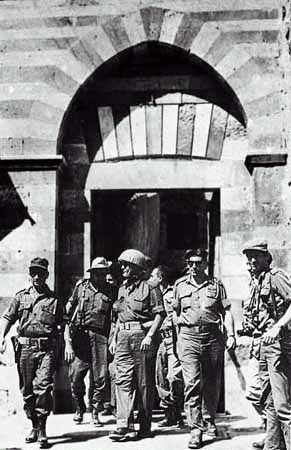 |
After the 1967 Six-Day War, the Jewish community of Hebron was re-established. On April 4, 1968, a group of Jews registered at the Park Hotel in the city. The next day they announced that they had come to re- establish Hebron's Jewish community. The actions sparked a nationwide debate and drew support from across the political spectrum. After an initial period of deliberation, Prime Minister Levi Eshkol's Labor-led government decided to temporarily move the group into a near-by IDF compound, while a new community -- to be called Kiryat Arba -- was built adjacent to Hebron. The first 105 housing units were ready in the autumn of 1972.
The Jewish community in Hebron itself was re-established permanently in April 1979, when a group of Jews from Kiryat Arba moved into Beit Hadassah. Following a deadly terrorist attack in May 1980 in which six Jews returning from prayers at the Tomb of the Patriarchs were murdered, and 20 wounded, Prime Minister Menachem Begin's Likud-led government agreed to refurbish Beit Hadassah, and to permit Jews to move into the adjacent Beit Chason and Beit Schneerson buildings in the old Jewish Quarter. An additional floor was built on Beit Hadassah, and 11 families moved in during 1986. Over the last two decades, many other Jewish properties and buildings in Hebron have been refurbished and rebuilt.
Religious Significance
The Cave of Machpelah, or Tomb of the Patriarchs, is the world's most ancient Jewish site and the second holiest place for the Jewish people, after the Temple Mount in Jerusalem. The cave was purchased by Abraham as a burial place for his wife Sarah some 3,700 years ago, along with the trees and field adjoining it, the first recorded transaction of a Hebrew buying land in Canaan (Genesis 23). Abraham, Isaac, Jacob, Rebecca, and Leah were all later buried in the same place. These are considered the patriarchs and matriarchs of the Jewish people. The only one who is missing is Rachel, who was buried near Bethlehem where she died in childbirth. Muslims believe that Joseph is also buried here, though Jews think he was buried in Nablus.
The building covering the cave was constructed roughly two thousand years ago by Herod. The 40-60 foot high walls are similar to those of the Temple Mount. Since Herod's time, the structure has been used by foreign conquerors as a shrine to their own religions. Thus, the Byzantines andCrusaders transformed it into a church and the Muslims converted it a mosque. About 700 years ago, the Mamelukes conquered Hebron, declared the structure a mosque and forbade entry to Jews, who were not allowed past the seventh step on a staircase outside the building.
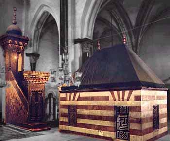 |
The structure is divided into three rooms: Ohel Avraham, Ohel Yitzhak, and Ohel Ya'akov. Presently Jews have access to Ohel Yitzhak, the largest room, only 10 days a year. The tombs are all underground. The visible parts are covered with tapestries and cenotaphs. A 700-year-old stained-glass window adorns the tomb of Jacob and Leah, which are in an adjoining courtyard opposite the monuments to Abraham and Sarah.
Hebron contains several other sites of Jewish religious and historical significance, including the Tombs of Othniel Ben Kenaz (the first Judge of Israel) and Avner Ben Ner (general and confidante to Kings Saul andDavid), and Ruth and Jesse (great-grandmother and father, respectively, of King David). Victims of the 1929 pogrom, as well as prominent rabbinical sages and community figures, are buried in Hebron's ancient Jewish cemetery.
In recent years, Hebron has been the site of many violent incidents, two of which stand out. In May 1980, Palestinian terrorists murdered six Jewish yeshiva students and wounded 20 others, who were returning from prayers at the Tomb of the Patriarchs. In February 1994, a Jew named Baruch Goldstein opened fire on Muslim worshippers at the Tomb, killing 29 and wounding 125.
Hebron Today
Hebron is home to approximately 120,000 Arabs, 500 Jews and a handful of Christians. On the outskirts of the city are glass-blowing, pottery and woodworking shops and, near the center of town, a large visitor center. The Arab market is similar to those elsewhere, but given the volatility of the city, visitors are usually discouraged from going there. The city also has a small museum of artifacts used in the area through the centuries.
Though Israel regained control of Hebron in 1967, the Cave of Machpelah has remained under the authority of the Muslim Waqf (Religious Trust), which continues to restrict Jewish access. No visitors are allowed inside during Muslim prayer times, Fridays or Muslim holidays.
Following the signing of the Interim Agreement on September 28, 1995, authority over most civilian matters concerning Hebron's Arab residents was transferred from the IDF Civil Administration to the Palestinian Authority and/or the (Arab) Municipality of Hebron. Those services which remained the responsibility of the Civil Administration were transferred to thePalestinian Authority and the Municipality following the IDF redeployment in Hebron in 1997. Since then, the Palestinians have controlled roughly 80 percent of the city and Israel 20 percent (including the area where Jews are living). International observers patrol the city to help monitor the situation.
At the time of Abraham, the Canaanite town in this place was known as Kiryat Arba. The name was later changed to Hebron (Joshua 14:15). Today, Kiryat Arba is the name of a suburb of Hebron, five minutes from the Cave of Machpelah and the heart of the city. Established in 1971, Kiryat Arba was the first renewed Jewish community in Judea and Samaria. Today, Kiryat Arba is home to more than 6,000 Jews who have a reputation for being among the most zealous defenders of the idea that Jews have a right to live in the West Bank. The town has educational institutions from pre-nursery school through post-High school, modern medical facilities, shopping centers, a bank and post office.
Jericho
Jericho is believed to be one of, if not the oldest cities in the world.
It was also the first city captured by the Israelites upon entering the land of Canaan following their 40 years of wandering in the desert after the exodus from Egypt.
Ironically, Jericho (along with the Gaza Strip) was the first territory given to the Palestinians by Israel as part of the Oslo peace agreement in 1994. Before the outbreak of the Palestinian War in 2000, the Palestinian Authority had been developing the town in hopes of making it a major tourist attraction, most notably erecting a large casino and hotel at the outskirts of the city.
History
Jericho sits between Mt. Nebo in the east, the Central Mountains to the west and the Dead Sea to the south. In addition to these natural fortifications, Jericho also benefited from natural irrigation afforded by the Jordan River approximately four miles to the west, and from underground tributaries from the Central Mountains which fed her famous oasis. This irrigation resulted in teeming plant life and helped to transform Jericho into a flowing sea of green in an otherwise barren desert. Besides being old, Jericho is also one of the lowest cities in the world, about 800 feet (244 m) below sea level.
Jericho's natural resources, beauty, and natural defenses caused her to become the ideal locale for trade. These attributes also made her the source of envy and a coveted possession for invaders of ancient Palestine. Given that Jericho is located in roughly central Palestine, access to her neighboring city-states was a major key to Jericho's importance to invaders and to traders alike. Jericho's location was ideal for the establishing of trade routes and for communication exchange.
According to Jewish tradition, after the Israelites' 40-year sojourn in the desert, Joshua decides the first city in Canaan he will conquer is Jericho. God tells him that he will be victorious and instructs Joshua to have his troops march around the walls of the city once a day for six days. The force is to be led by seven priests walking beside the Ark of the Covenant containing the Ten Commandments and blowing rams' horns (shofarot). On the seventh day, the troops are supposed to circle the city seven more times, then the priests are ordered to blow their horns and the soldiers to shout, and the walls of the city, God tells Joshua, will tumble down. This is precisely what happens according to the Bible (Joshua 6).
Jericho later fell to the Babylonians, but was rebuilt when the Jews were allowed to return from their exile. The city continued to be a resort during the rule of the succeeding empires. For Christians, Jericho took on importance because of its association with John the Baptist, who was said to have been baptized by the banks of the Jordan on the eastern boundary of the city (Matthew 3:13-15), and the story of the temptation of Christ (Matthew 4:1-4).
The Romans destroyed the old city in the first century, but it was rebuilt in its present location by the Byzantines. The city briefly returned to glory when Caliph Hisham Ibn Abd el-Malik built his winter palace in Jericho in 743, but an earthquake destroyed virtually the entire city just four years later. The city later fell to the Crusaders and then was recaptured by Saladin. Jericho was largely ignored and deserted for centuries afterward.
The UN partition decision allocated the area to the Arab state, but, after the 1948 war, it was controlled by Jordan. Many Arabs who left other parts of Palestine moved to the area and a number of UN refugee camps were set up. A Palestinian nationalist named Musa Alami founded an agricultural school to train refugees in 1951, which is still in operation. The territory was subsequently captured by Israel in the Six-Day War.
Sites
The main attraction in Jericho is the Tel e-Sultan, the site of ancient Jericho. In reality, little remains beyond a few piles of rocks that archaeologists now tell us were once parts of towers, staircases and other structures that date back at least 7,000 years. The oldest stairs and wall in the world are on the site. The layers of 23 ancient civilizations were uncovered here and may be as much as 9,000 years old.
 |
Nearby is the Spring of Elisha, or Sultan's Spring, where the prophet sweetened the water (II Kings 2). This is the source of water for the oasis. During the construction of a private home north of the spring, builders discovered the mosaic floor of an ancient synagogue decorated with Jewish symbols, such as amenorah and ram's horn. A Hebrew inscription reads, "Peace to Israel." This is the Shalom Al Yisrael Synagogue. A second, older synagogue, which is believed to have been built in the 5th or 6th century, was also discovered by accident. The Na'aran Synagogue was found after the Ottoman Turks shelled a British army unit camped on the spot. It too has a mosaic floor, this one with the Zodiac, the story of Daniel in the Lion's Den and pictures of sacred objects from the Temple.
Directly across from the Tel is a huge tourist complex with shops and a restaurant where every tour bus stops. A new hotel is being constructed as well. Another new addition since the Palestinian takeover is a modern cable car that whisks visitors to the Mount of Temptation. A 19th-century Greek Orthodox monastery sits on the cliff. This is where Satan offered Jesus the kingdoms of the world in exchange for his homage. Inside the monastery is a cave where Jesus is believed to have stayed during the 40 days he spent in the wilderness fasting after his baptism. At the foot of the mountain are the remains of the sugar mills built by the Crusaders in the 11th century.
Less than two miles from Old Jericho is Caliph Hisham's Palace. The building dates to the 7th century during the Umayyad period of the Muslim Empire. It was apparently designed as a winter resort from the Caliph, but was destroyed by an earthquake before he had a chance to use it. Parts of the building were preserved and some of the artifacts were removed and are on display at the Rockefeller Museum in Jerusalem.
Jericho biggest tourist attraction at one point was Oasis casino - built in 1995 following the peace agreement signed between the Palestinians and Israelis- which was the only legal gambling establishment in the region, and a magnet for Israelis. In 1999, it made a profit of $54 million from the close to 2,900 people who visited the casino daily - 99% of them Israelis. In 2000, though, after the outbreak of violence during the Palestinian War, the casino was shut down. The juxtaposition of the casino, located directly across the street from a Palestinian refugee camp, was not lost on Palestinian terrorists who began using its high roof to shoot at nearby Israeli targets. Today the casino remains closed, despite an attempt by an Israeli businessman to reopen it back in 2005.
About four miles east of Jericho (six km.) is the Allenby Bridge, one of the two crossing points into Jordan. The bridge is named after the famous general who led British troops during World War I and helped conquer much of the Middle East, including Palestine.
Nablus (Shechem)
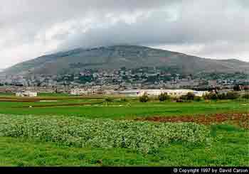 |
Nablus, known as the site of biblical Shechem, is one of the largest Palestinian cities with a population of more than 50,000 people.
The area of Biblical Shechem can be found in the Balata neighborhood in the south-eastern section of the city.
Historically, Abraham traveled through Shechem on his way to Canaan and here offered his first sacrifice to G-d. After the conquest of Canaan, Joshua assembled the Israelites here and encouraged them to follow the Mosaic laws. During the period of the Judges, Abimelech was crowned king here.
Inside the area known as Biblical Shechem are the remains of a defensive wall, a 3,600-year-old Hyksos temple and Joseph’s Tomb. During an outbreak of violence in October 2000, Palestinian rioters destroyed Joseph’s Tomb, looting the insides and destroying the Jewish artifacts found inside. Though mostly now in ruins, the IDF semi-regularly coordinates visits to the site for prayer services.
Another site related to the biblical patriarch is Jacob’s well, found inside a Greek Orthodox monastery. This site is also holy for Christians who believe Jesus spoke here to a Samaritan woman.
Mount Gerizim is another place considered holy by the Jews and the Samaritans. A Samaritan temple was built on Mount Gerizim in the 4th century BCE. At the end the second century BCE, the temple was destroyed by Yohanan Hyrcanos I and was converted into a Temple to Zeus by Antiochus II in 170 BCE. In 484, the site changed hands again, this time to the Byzantine emperor Zenon, who built a church on the site. Today, only 600 Samaritans remain and about half live in Nablus and the other half live in Holon, near Tel Aviv. Every year the Samaritans continue to make an annual Passover sacrifice on Mount Gerizim.
West of Mount Gerizim, is the Samaritan quarter. Inside the quarter, there is a synagogue that contains Samaritan Torah scrolls believed to date back to the 13th year of settlement of the Israelites in Canaan.
The modern city of Nablus derived its name from a Roman town that was founded in 72 CE, which was close to the biblical city of Shechem. Originally the town was known as Flavia Neopolis, but it was eventually shortened into Nablus, after the Arab conquest in 636 CE.
During the period of the Crusader rule, in the 12th century, Nablus was renamed Naples. A palace and citadel were built by the Crusaders and it became the second most important city in the kingdom.
Inside the city of Nablus, at the entrance to the casbah, the traditional city center, there are the remains of an amphitheater built in the 3rd century CE, when Nablus was a Roman city. Near Nablus’s market is a tower erected in 1902 by the Turkish Sultan Abdul Hamid, a house used by the Turkish governor and the main mosque.
It times of unrest in the region, Nablus is often a focal point of protests and not safe for visitors.
Ariel
With the approval of the Israeli government in 1978, 40 families led by Ron Nachman settled on top of the rocky and barren hill that would become the City of Ariel.
The government subsequently gave the outpost "development-town" status and the residents chose the name Ariel, a Biblical reference to Jerusalem and the Temple Mount.
Two years later, in 1980, construction began on Ariel's first neighborhood, the first Jewish homes built in the Shomron region in 2000 years.
The capital of Samaria, Ariel is located in the West Bank, 25 miles east of Tel Aviv , 25 miles west of the Jordan River and 31 miles north of Jerusalem. The city stretches 8 miles in length and is situated almost 2,000 feet above sea level. The western tip of the city (i.e., the part closest to Israel) is about 10 miles from the Green Line, and the eastern edge of the settlement is more than 13 miles from the Green Line.
Ariel has a population of 18,000 residents and is one of only four settlements classified by Israel as a “city.” Another 8,500 people are students in the College of Judea and Samaria (which was upgraded to the status of a university in 2005). More than 45 percent of Ariel's population areimmigrants from the former Soviet Union.
Ariel has 26 preschools, 4 elementary schools, a religious school (grades 1-9), two junior high schools and a high school. Ariel's new Sports & Recreation Complex will ultimately house an indoor swimming pool, sauna, whirlpool, showers and changing rooms, a multi-purpose hall, activity and games rooms, a day care center, kitchen and cafeteria, lobby, reception and offices. Tennis courts, a miniature golf course, gymnasium and fitness center have already been completed and are operating full-time.
Most of Ariel residents are secular; only about 10 percent of of the population is Orthodox. Though affiliated with the political right, the Jews in Ariel are not considered hardline ideologues. Rather, most moved there because of the higher standard of living they enjoy and the economic incentives provided by the government. In particular, residents can obtain better mortgages and repayment terms because the government designated Ariel as a “national priority” development area.
In 1985, Ron Nachman became the first elected mayor of Ariel, and he's been reelected four times since, most recently in 2004.
The city is not known for its sites; it is not in an area of any relgious significance, but many tourists visit Ariel because it is one of the safer places to see what life is s like in the West Bank. Ariels is also an example of a successful development town.
Ariel is now the heart of the most populous bloc of settlements, which includes Kedumim, Karnei Shomron, Ma'ale Shomron, Bet Arye, Ofarim, Nofim, Yaqir, Immanuel, Peduel, Alei Zahav, Brukhin, Barkan, Kiryat Netafim, and Revava. This bloc is approximately 47 square miles and includes about 37,000 settlers. On February 20, 2005, the Israeli government approved a route for the security barrier that includes the Ariel bloc, but this portion of the fence has not been completed yet, in part because of opposition from the United States.
The city's position expands Israel's narrow waist (which was 9 miles wide before 1967) and ensures that Israel has a land route to the Jordan Valley should Israel needs to fight a land war to the east. Because of its size, most Israelis favor the incorporation of the Ariel bloc within whatever may be the final borders of Israel. It is more controversial than the other “consensus” settlementsbecause it is the furthest from the 1949 Armistice Line. Nevertheless, Prime Minister Barak’s proposal at Camp David included Ariel among the settlement blocs to be annexed to Israel; theClinton plan also envisioned incorporating Ariel within the new borders of Israel.
The End ... is Just the Beginning
Well, we've come to the end of our tour. We here at the American-Israeli Cooperative Enterprise (AICE) hope you've enjoyed getting to see Israel and learn more about its history, people and culture.
You haven't seen it all. Until you see Israel for yourself, you can't appreciate the beauty, the spirituality and the vibrance of the country and its people. We will be constantly adding new information to our tour. As our Jewish Virtual Library grows each month, more information will be added under eachmajor and additional links created within each stop on the tour. In addition, the tour will grow as more towns and sites are added to the itinerary.
We want to hear from you about what you thought about the Virtual Israel Experience and your real life experience in Israel if you've had the good fortune to visit. This feedback will help us improve this site and allow us to tell trip organizers what they are doing right and can do better to make tours even more meaningful and enjoyable in the future. So please click here to go on to our brief evaluation form.
Thank you for visiting Israel with AICE and we hope to see you again on the Virtual Israel Experience and this year in Jerusalem!
EFRAT
EFRAT (Heb. אפרת), urban community with municipal council status, located in the *Gush Etzyon area south of Jerusalem. Its area is 1.5 sq. mi. (4 sq. km.). Efrat was established in 1983 after planning by an Israeli group and an American group led by Rabbi Shlomo *Riskin of New York, who settled in Efrat and became the town's rabbi. When the first families arrived the Shevut Yisrael Yeshivah, one of the hesder yeshivot, was functioning on the site. Efrat was unique among the West Bank settlements in that settlers moved immediately into permanent housing. Neighborhoods are named after the seven species for which the Land of Israel was famous in biblical times (Deut. 8:8). In 2002 the population of Efrat was 6,810, mainly religious people. Many of its inhabitants are Anglo-Saxons.
WEBSITE:
[Shaked Gilboa (2nd ed.)]
hi my name is jack hazut my web sit is wwwisraelimage.net you have been using my photo without my permission please contact me today jackhazut@yahoo.com
ReplyDeleteJack Hazut
Photos from Israel and the world
www.israelimage.net
www.facebook.com/jack.hazut
Great post... you have shared. thanks for sharing.
ReplyDeleteApartment Holiday Rental Herzliya